
Image: CaliFOURnia map

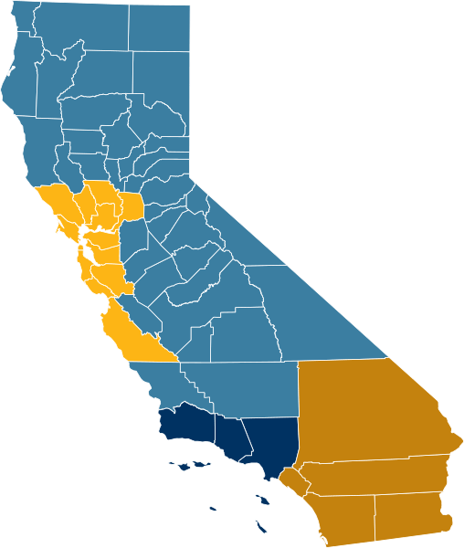
Description: Map of the four states proposed by Martin Hutchinson in 2009. Source: Hutchinson, Martin (2009-05-21). "Califournia Breakup?". Thomson Reuters. Archived from the original on 8 July 2011. Retrieved on 23 February 2011. San Diego/Orange County/Inland Empire(listed as "five counties", so w:Inland Empire imputed to include Riverside, San Bernardino, and Imperial counties) Greater Los Angeles(three counties, explicitly listed as LA, Ventura, and Santa Barbara) San Francisco/Sacramento/Santa Cruz/Silicon Valley(thirteen counties, imputed to include the nine Bay Area counties, Sacramento, Santa Cruz, Yolo as part of Sacramento MSA, and Monterey, based on politics) Northern/Central Valley
Title: CaliFOURnia map
Credit: Own work
Author: Mliu92
Usage Terms: Creative Commons Attribution-Share Alike 4.0
License: CC BY-SA 4.0
License Link: https://creativecommons.org/licenses/by-sa/4.0
Attribution Required?: Yes
Image usage
The following page links to this image:
