
Image: Caliphate 740-en

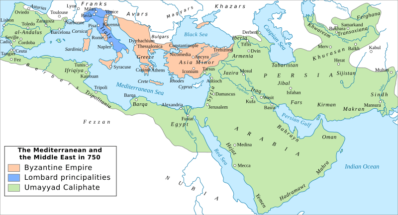
Description: Map of the Mediterranean and Middle Eastern worlds around 740 CE. The original map(s) this is derived from are for the year 750, but neither the Abbasid Revolution nor the effects of the great Berber Revolt are shown on them, so the correct date for the 'maximum' extent of the Umayyad Caliphate should be around 740. Modifications to the basemap include: removal of the conquest dates and different borders of the caliphate, since this is meant to show the situation at a specific timeframe, rather than be a map of the Muslim expansion the addition of some cities and removal of others (for example, Baghdad and Cairo are removed) to fit the timeframe additional geographic regions western and eastern boundaries of the Caliphate have been reduced to remove the space-filling tendencies of Califate 750.jpg, since the Arabs never really controlled the interior of the Maghreb (cf. Halm's Das Reich des Mahdi, or Talbi's L'émirat aghlabide for the situation in even later times) nor of Zabulistan etc (cf. the repeated campaigns of the governors of Sijistan even into the 9th/10th centuries). Further sources used for verification: An Historical Atlas of Islam, Brill 1981, maps 8, 32, 52; Atlas of Islamic History, Routledge 2014, map 4 Any suggestions for improvement or fixing errors/omissions are welcome.
Title: Caliphate 740-en
Credit: Derived from Caliphate 750-es.svg, which ultimately derives from Califate 750.jpg and similar. Own work: modifications on the base map (see description)
Author: Constantine Plakidas
Usage Terms: Creative Commons Attribution-Share Alike 4.0
License: CC BY-SA 4.0
License Link: https://creativecommons.org/licenses/by-sa/4.0
Attribution Required?: Yes
Image usage
The following page links to this image:
