
Image: Campaigns of Stefan Batory

Size of this PNG preview of this SVG file: 796 × 600 pixels. Other resolution: 319 × 240 pixels.
Original image (SVG file, nominally 848 × 639 pixels, file size: 50 KB)
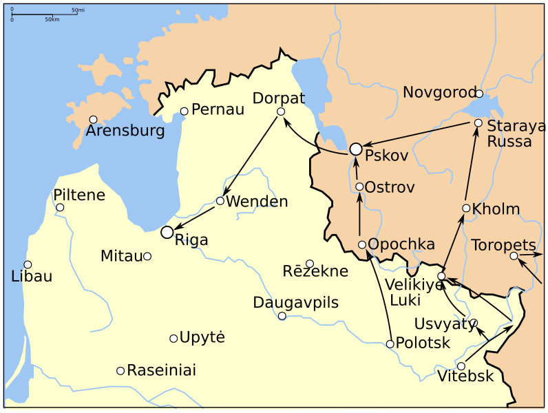
Description: Map showing the campaigns in Livonia and Western Russia of Stefan Batory during the Livonian War. The dark line is the approximate border by 1600.
Title: Campaigns of Stefan Batory
Credit: Own work; (File:Map of Poland and Lithuania in 1600.svg and File:Campaigns of Stefan Batory (1578-82).png)
Author: Grandiose
Usage Terms: Creative Commons Attribution-Share Alike 3.0
License: CC BY-SA 3.0
License Link: https://creativecommons.org/licenses/by-sa/3.0
Attribution Required?: Yes
Image usage
The following page links to this image:

All content from Kiddle encyclopedia articles (including the article images and facts) can be freely used under Attribution-ShareAlike license, unless stated otherwise.