
Image: CanyonsbathyLG USGS
Size of this preview: 497 × 600 pixels. Other resolutions: 199 × 240 pixels | 1,040 × 1,255 pixels.
Original image (1,040 × 1,255 pixels, file size: 375 KB, MIME type: image/jpeg)
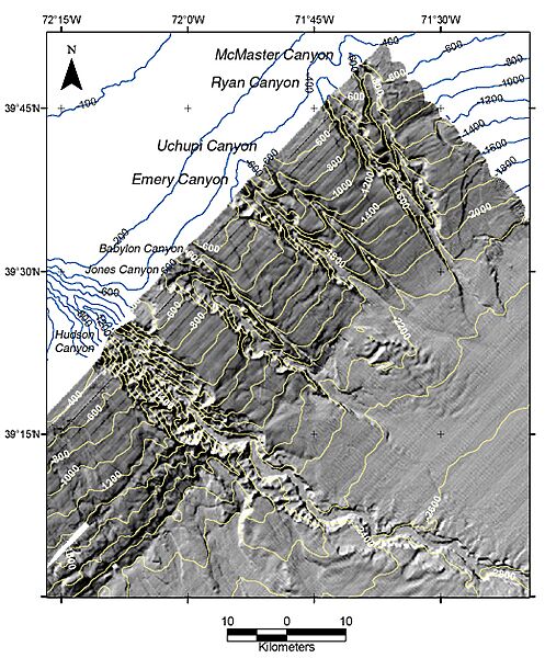
Description: "Continental slope and upper continental rise northeast of Hudson Canyon, showing the four newly named submarine canyons along the continental slope: Emery, Uchupi, Ryan, and McMaster. Shaded-relief bathymetric imagery constructed by Tammie Middleton from multibeam bathymetric data collected on the NOAA ship Ronald H. Brown, 2002. Contour interval, 100 m; dark blue lines were derived from the NOAA Coastal Relief Model, and light yellow lines from multibeam bathymetric data collected in 2002."
Usage Terms: Public domain
Image usage
The following page links to this image:

All content from Kiddle encyclopedia articles (including the article images and facts) can be freely used under Attribution-ShareAlike license, unless stated otherwise.