
Image: Cape Colony map 1876 - Eve of Confederation Wars
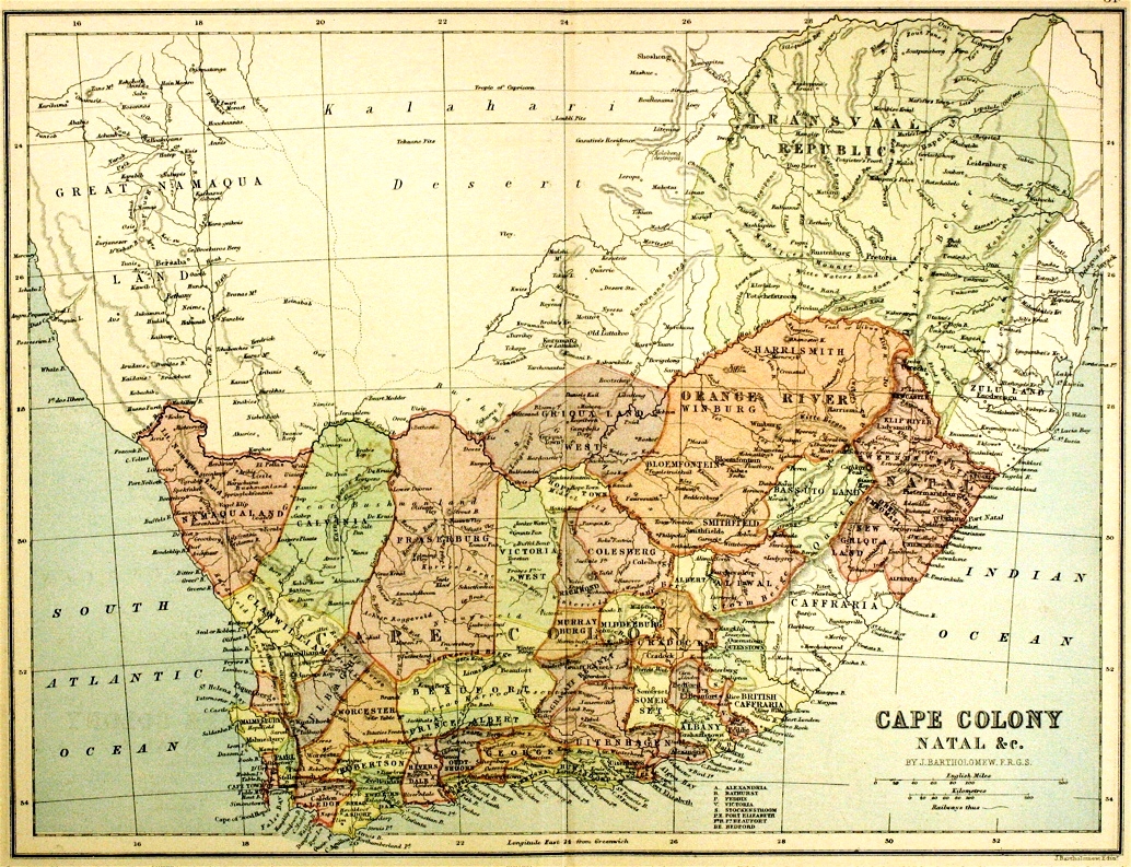
Size of this preview: 782 × 600 pixels. Other resolutions: 313 × 240 pixels | 1,034 × 793 pixels.
Original image (1,034 × 793 pixels, file size: 687 KB, MIME type: image/jpeg)
Description: Early map of the Cape of Good Hope in 1876. Before the Confederation Scheme and the Anglo-Zulu War. Showing new electoral divisions instituted by Molteno Government.
Usage Terms: Public domain
Image usage
The following page links to this image:

All content from Kiddle encyclopedia articles (including the article images and facts) can be freely used under Attribution-ShareAlike license, unless stated otherwise.