
Image: CapitalDistrictCounties2

Size of this PNG preview of this SVG file: 800 × 280 pixels. Other resolution: 320 × 112 pixels.
Original image (SVG file, nominally 823 × 288 pixels, file size: 33 KB)
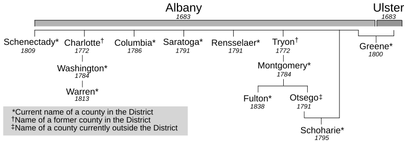
Description: Timeline of the creation of the counties located within the Capital District of New York, United States[1] Reference: ↑ French, John Homer; Frank Place (1860) Gazetteer of the State of New York (7th ed.), R.P. Smith and Harvard University, pp. 155—167
Title: CapitalDistrictCounties2
Credit: Own work
Author: SVG: ZooFari; Raster: Wadester16
Usage Terms: Public domain
License: Public domain
Attribution Required?: No
Image usage
The following 2 pages link to this image:

All content from Kiddle encyclopedia articles (including the article images and facts) can be freely used under Attribution-ShareAlike license, unless stated otherwise.