
Image: Capri sights

Size of this preview: 800 × 440 pixels. Other resolutions: 320 × 176 pixels | 2,000 × 1,100 pixels.
Original image (2,000 × 1,100 pixels, file size: 386 KB, MIME type: image/png)
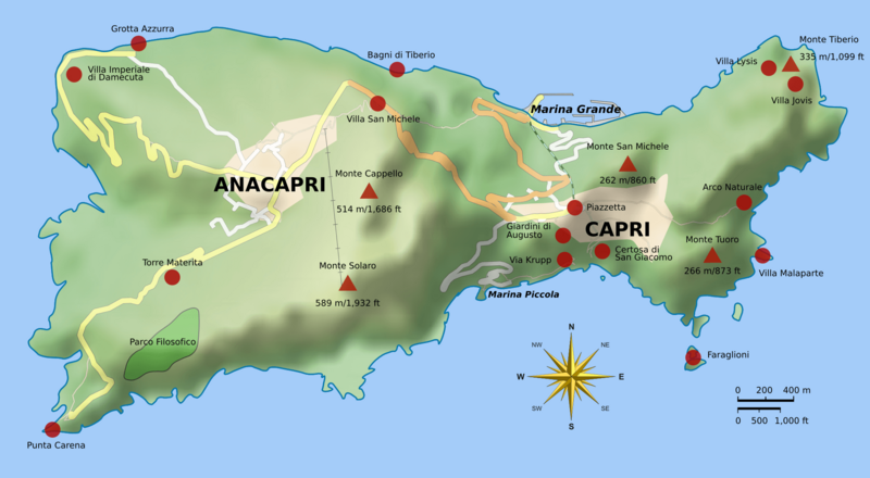
Description: Map of Capri. Uses terrain data from SRTM3 (http://dds.cr.usgs.gov/srtm/version2_1/SRTM3/Eurasia/N40E014.hgt.zip). Bitmap version of File:Capri_sights_terrain.svg. Note: An offical map of Capri (with roads, etc.) can be found at http://www.capritourism.com/imgg/download/capri_map_en.pdf
Title: Capri sights
Credit: Own work
Author: Morn the Gorn compass rose from Maps_template-fr.svg: Eric Gaba (Sting - fr:Sting) Road and rail data from OpenStreetMap
Usage Terms: Creative Commons Attribution-Share Alike 3.0
License: CC BY-SA 3.0
License Link: https://creativecommons.org/licenses/by-sa/3.0
Attribution Required?: Yes
Image usage
The following page links to this image:

All content from Kiddle encyclopedia articles (including the article images and facts) can be freely used under Attribution-ShareAlike license, unless stated otherwise.