
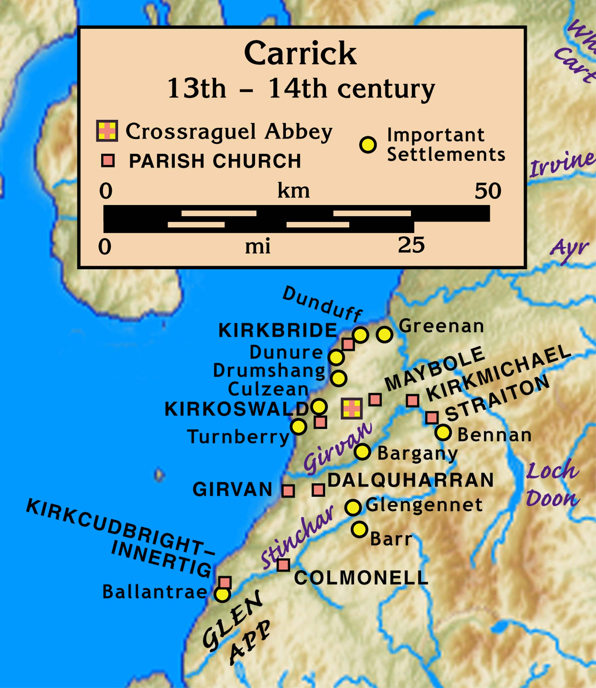
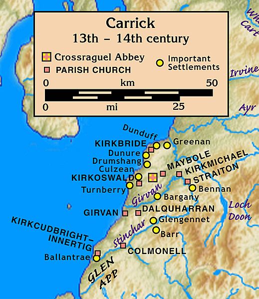
Image: Carrick.13th.to.14th.century
Description: Carrick, 13th – 14th century
Title: Carrick.13th.to.14th.century
Credit: Own work placement is by a wikipedian's specification, with locations of places that still exist having been checked against maps.google.com; parishes and settlements are located on various maps in Peter G. B. McNeill, Hector L. MacQueen, and Anna May Lyons (eds.), Atlas of Scottish History to 1707 (reprinted with corrections ed.), (The Scottish Medievalists and Department of Geography, University of Edinburgh, Edinburgh, 2000) [p. 350 for map of parishes of the deanery of Carrick] The topographical map is from a sub-region of File:Uk topo en.jpg, with the copyright notice Template:Bild-GFDL-GMT and original date of 7 July 2006, copy made in 2008, with the annotations removed by myself.
Author: myself, plus wikipedian who specified the sites
Usage Terms: Creative Commons Attribution-Share Alike 3.0
License: CC BY-SA 3.0
License Link: https://creativecommons.org/licenses/by-sa/3.0
Attribution Required?: Yes
Image usage
The following page links to this image:
