
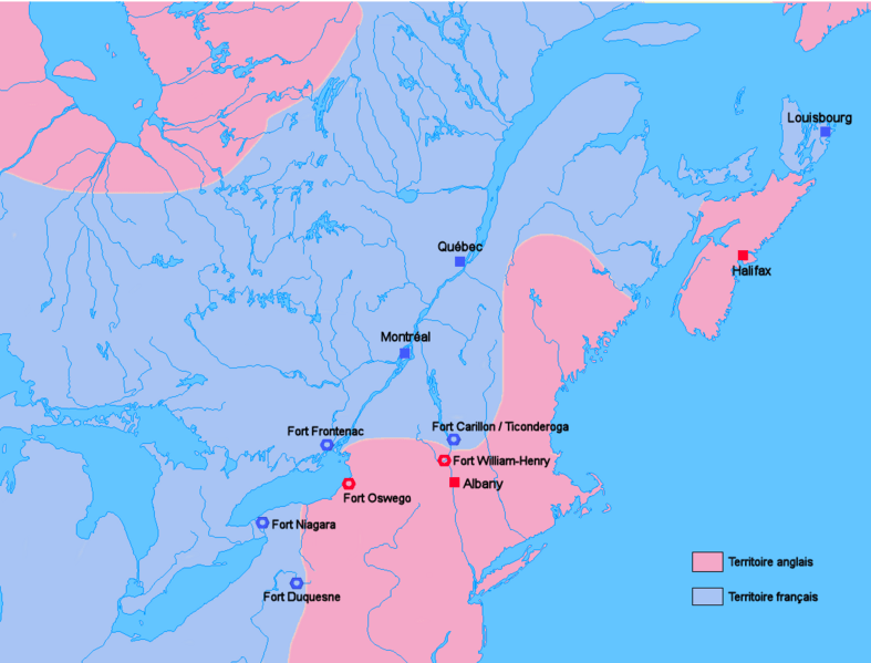
Image: Carte Guerre de 7 ans Amérique du nord

Size of this preview: 787 × 599 pixels. Other resolutions: 315 × 240 pixels | 1,120 × 853 pixels.
Original image (1,120 × 853 pixels, file size: 92 KB, MIME type: image/png)
Description: Map of English and French positions in North America just before the beginning of the Seven Years' War.
Title: Carte Guerre de 7 ans Amérique du nord
Credit: No machine-readable source provided. Own work assumed (based on copyright claims).
Author: No machine-readable author provided. Wordelle assumed (based on copyright claims).
Usage Terms: Public domain
License: Public domain
Attribution Required?: No
Image usage
The following 2 pages link to this image:

All content from Kiddle encyclopedia articles (including the article images and facts) can be freely used under Attribution-ShareAlike license, unless stated otherwise.