
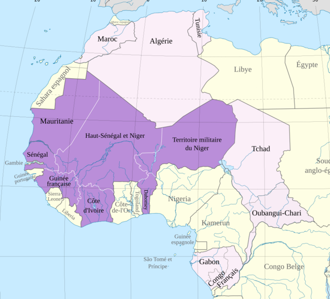
Image: Carte de l'Afrique-Occidentale française, 1914

Size of this PNG preview of this SVG file: 661 × 599 pixels. Other resolution: 265 × 240 pixels.
Original image (SVG file, nominally 868 × 787 pixels, file size: 1.7 MB)
Description: Carte de l'Afrique-Occidentale française en l'an 1914
Title: Carte de l'Afrique-Occidentale française, 1914
Credit: Africa map 1914.svg
Author: Hogweard
Permission: Public domainPublic domainfalsefalse I, the copyright holder of this work, release this work into the public domain. This applies worldwide. In some countries this may not be legally possible; if so: I grant anyone the right to use this work for any purpose, without any conditions, unless such conditions are required by law.
Usage Terms: Public domain
License: Public domain
Attribution Required?: No
Image usage
The following 2 pages link to this image:

All content from Kiddle encyclopedia articles (including the article images and facts) can be freely used under Attribution-ShareAlike license, unless stated otherwise.