
Image: Carte de l'isle de Mari-Galante. LOC 74691009

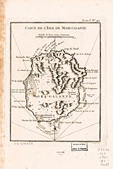
Description: Scale ca. 1:200,000. Relief shown by hachures. "Tome I, no. 90." From the author's Le petit atlas maritime. 1764. LC Maps of North America, 1750-1789, 2027 Available also through the Library of Congress Web site as a raster image. Vault AACR2
Title: Carte de l'isle de Mari-Galante. LOC 74691009
Credit: https://www.loc.gov/item/74691009/
Author: [Bellin, Jacques Nicolas]; Croisey, P.
Permission: This map is available from the United States Library of Congress's Geography & Map Division under the digital ID g5072m.ar202700. This tag does not indicate the copyright status of the attached work. A normal copyright tag is still required. See Commons:Licensing.
Usage Terms: Public domain
License: Public domain
Attribution Required?: No
Image usage
The following page links to this image:
