
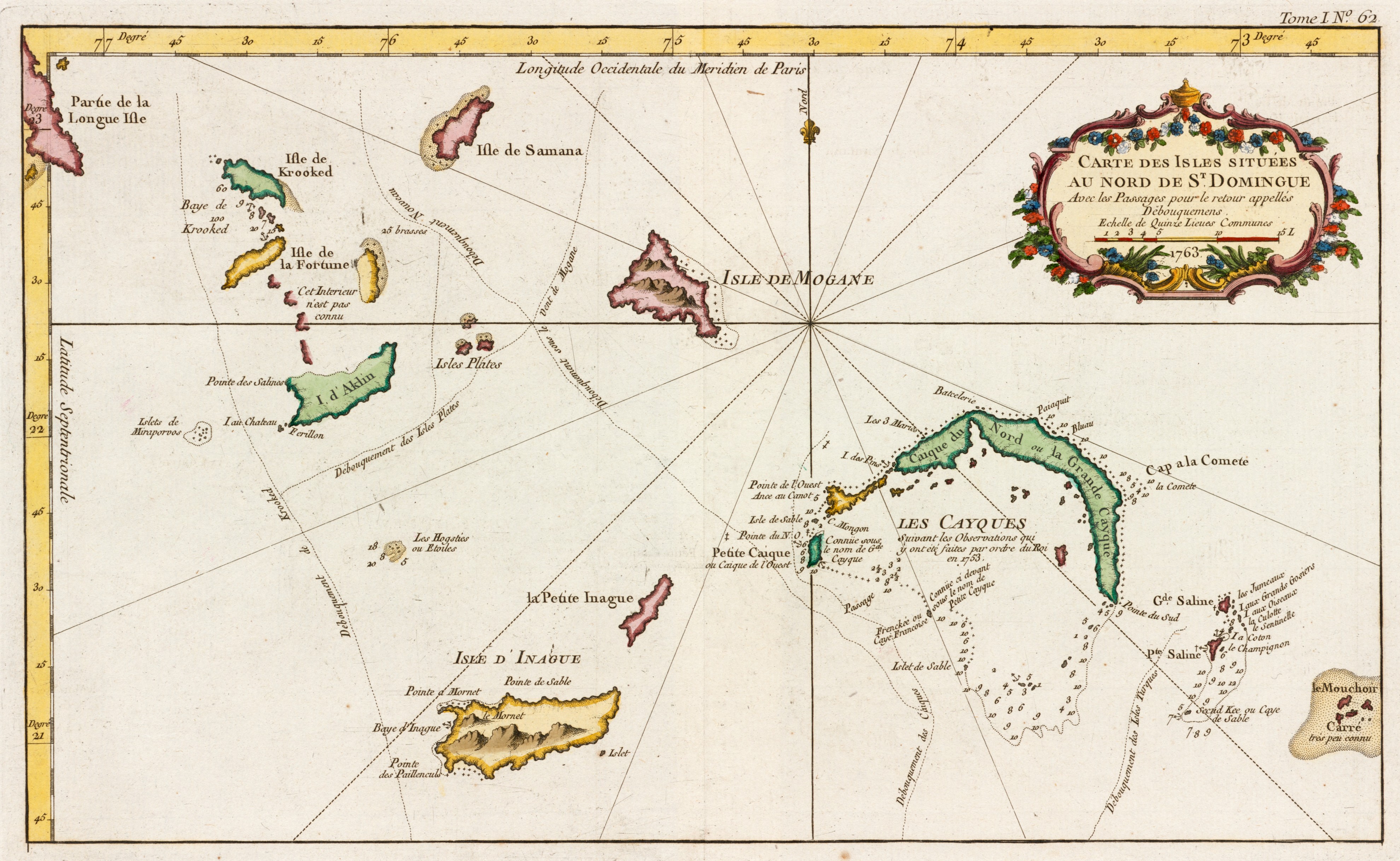
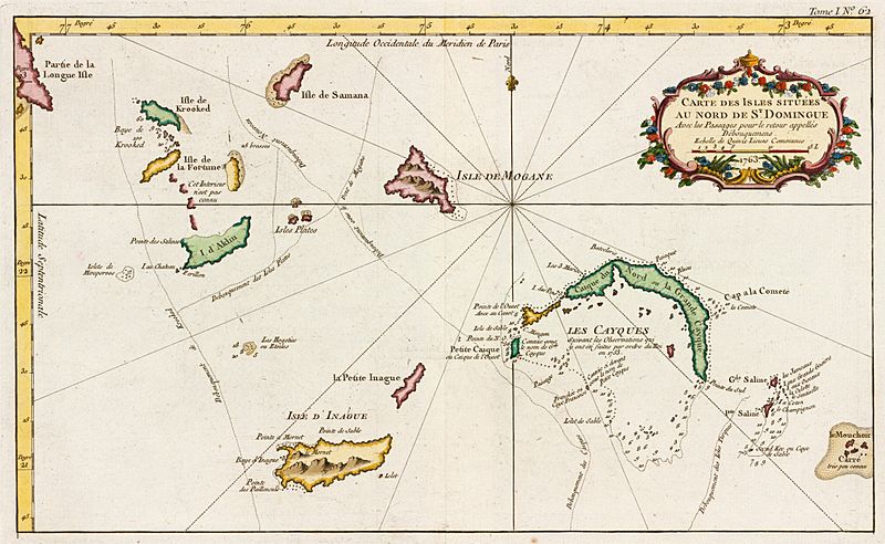
Image: Carte des isles situées au nord de St. Domingue (2674965842)
Size of this preview: 800 × 492 pixels. Other resolutions: 320 × 197 pixels | 3,960 × 2,436 pixels.
Original image (3,960 × 2,436 pixels, file size: 2.09 MB, MIME type: image/jpeg)
Description: Zoom into this map at maps.bpl.org. Author: Bellin, Jacques Nicolas Publisher: Jacques Nicolas Bellin Date: [1763] Location: Turks and Caicos Islands Scale: 1:314,563 Call Number: G4985 1764.B4
Title: Carte des isles situées au nord de St. Domingue (2674965842)
Credit: Carte des isles situées au nord de St. Domingue Uploaded by tm
Author: Jacques-Nicolas Bellin
Usage Terms: Creative Commons Attribution 2.0
License: CC BY 2.0
License Link: https://creativecommons.org/licenses/by/2.0
Attribution Required?: Yes
Image usage
The following page links to this image:

All content from Kiddle encyclopedia articles (including the article images and facts) can be freely used under Attribution-ShareAlike license, unless stated otherwise.
.jpg)