
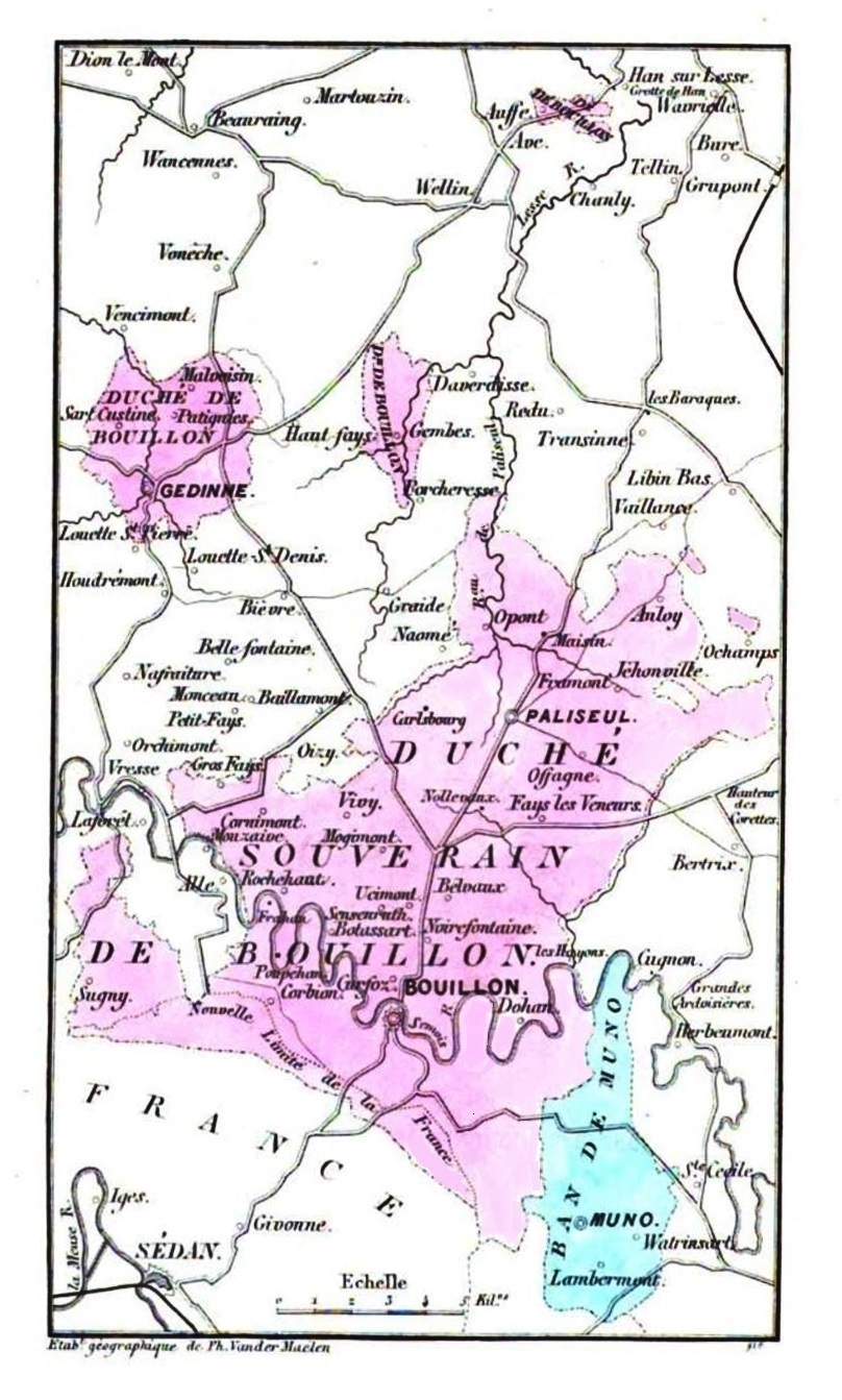
Image: Carte du Duché de Bouillon (1864)
Size of this preview: 360 × 598 pixels. Other resolutions: 144 × 240 pixels | 808 × 1,343 pixels.
Original image (808 × 1,343 pixels, file size: 323 KB, MIME type: image/jpeg)
Description: Map showing (in purple) the boundaries of the former Duchy of Bouillon. The area in aqua was a fief that had once belonged to the duchy. This discolored map was included in the book titled Histoire de la ville et du duché de Bouillon, by M. J. F. Ozeray (Brussels, 2nd edition, 1864).
Title: Carte du Duché de Bouillon (1864)
Credit: Google eBooks
Author: Établissement géographique Ph. van der Meilen, Belgium, c. 1864
Usage Terms: Public domain
License: Public domain
Attribution Required?: No
Image usage
The following 2 pages link to this image:

All content from Kiddle encyclopedia articles (including the article images and facts) can be freely used under Attribution-ShareAlike license, unless stated otherwise.
.jpg)