
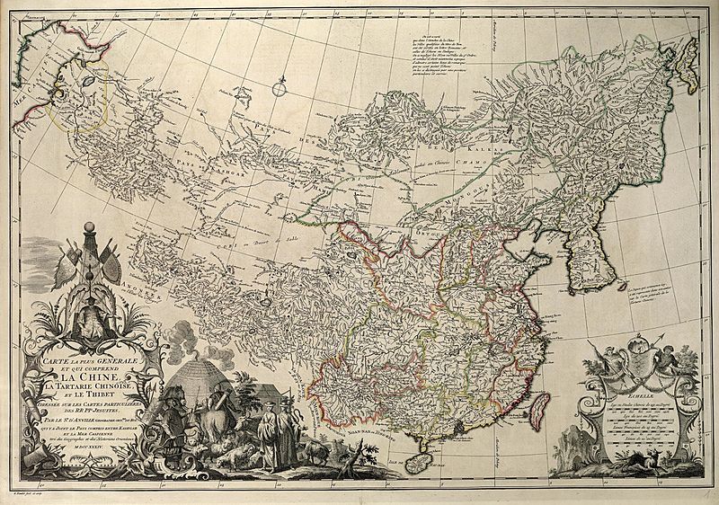
Image: Carte la plus generale et qui comprend la Chine, la Tartarie Chinoise, et le Thibet (1734)

Size of this preview: 800 × 562 pixels. Other resolutions: 320 × 225 pixels | 3,000 × 2,106 pixels.
Original image (3,000 × 2,106 pixels, file size: 3.14 MB, MIME type: image/jpeg)
Description: Entire map
Title: Carte la plus generale et qui comprend la Chine, la Tartarie Chinoise, et le Thibet (1734)
Credit: [1]
Author: Jean Baptiste Bourguignon d'Anville
Permission: Author died more than 70 years ago - public domain
Usage Terms: Public domain
License: Public domain
Attribution Required?: No
Image usage
The following page links to this image:

All content from Kiddle encyclopedia articles (including the article images and facts) can be freely used under Attribution-ShareAlike license, unless stated otherwise.
.jpg)