
Image: Castor Temple from Jicarilla Point

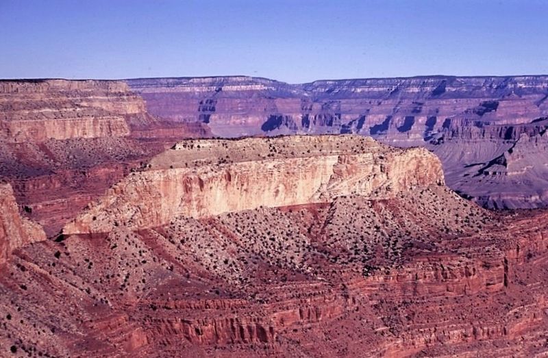
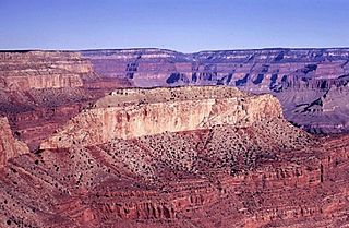
Description: View northwest toward Castor Temple from Jicarilla Point, south rim of Grand Canyon, about 2.5 miles southwest of river mile 102.0. Castor Temple capped by cliff of Brady Canyon Member of Toroweap Formation (thin ledge with trees), which overlies Seligman Member of Toroweap Formation (gray slope), Coconino Sandstone (sheer white cliff), Hermit Formation (red slope), Esplanade Sandstone (red ledges), and Wescogame and Manakacha Formations (lower red ledges and slopes). Muav Fault and Crazy Jug Monocline between Swamp Point (east) and Powell Plateau (west) in distant skyline.
Title: Castor Temple from Jicarilla Point
Credit: https://www.sciencebase.gov/catalog/item/5c75aa3ae4b0fe48cb4a599a
Author: George Billingsley, U.S. Geological Survey
Usage Terms: Public domain
License: Public domain
Attribution Required?: No
Image usage
The following page links to this image:
