
Image: Caucasus 1060 map en

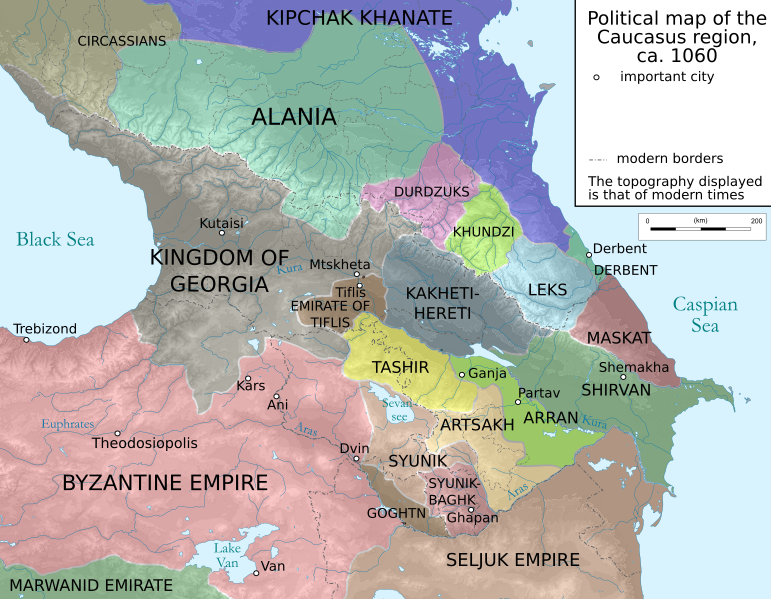
Description: Political map of the Caucasus region in ca. 1060 CE.
Title: Caucasus 1060 map en
Credit: Translated into English from the German original: Caucasus 1060n map de.png. Sources listed there: Putzger historischer Weltatlas, 2005 Edition; Heinz Fähnrich: Geschichte Georgiens von den Anfängen bis zur Mongolenherrschaft. Shaker, Aachen 1993, ISBN 3-86111-683-9, File:Shaddadid.gif, File:Jorgat harasm.gif , File:Arcax.jpg, File:Geor david.gif, File:Arcax.jpg , http://www.armenica.org/cgi-bin/armenica.cgi?178711717323498=1=3==Armenia==1=3=AAA , File:Alania_10_12.png and their respective sources
Author: Constantine Plakidas
Usage Terms: Creative Commons Attribution-Share Alike 3.0
License: CC BY-SA 3.0
License Link: https://creativecommons.org/licenses/by-sa/3.0
Attribution Required?: Yes
Image usage
The following page links to this image:
