
Image: Ceratopsian map
Size of this preview: 800 × 352 pixels. Other resolutions: 320 × 141 pixels | 1,427 × 628 pixels.
Original image (1,427 × 628 pixels, file size: 46 KB, MIME type: image/png)
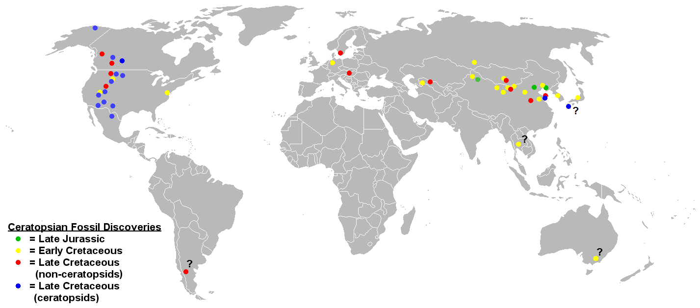
Description: Map of ceratopsian fossil localities as of September 2006. I used the blank political map of the world commonly used on Wikipedia ((BlankMap-World.png). Keep in mind that the land masses would not have been in the same places they are today in the Jurassic and Cretaceous periods.
Title: Ceratopsian map
Credit: Transferred from en.wikipedia to Commons by FunkMonk using CommonsHelper.
Author: Sheep81 at English Wikipedia
Usage Terms: Public domain
License: Public domain
Attribution Required?: No
Image usage
The following page links to this image:

All content from Kiddle encyclopedia articles (including the article images and facts) can be freely used under Attribution-ShareAlike license, unless stated otherwise.