
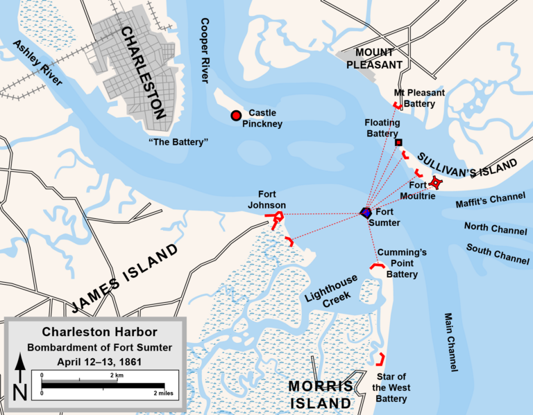
Image: Charleston Harbor 1861

Description: Map of the harbor of Charleston, South Carolina, showing Confederate forts and the bombardment of Fort Sumter, April 1861. Drawn in Adobe Illustrator CS5 by Hal Jespersen. Graphic source file is available at http://www.posix.com/CWmaps/ This file is licensed under the Creative Commons Attribution 3.0 Unported license. Attribution: Map by Hal Jespersen, www.posix.com/CW You are free: to share – to copy, distribute and transmit the work to remix – to adapt the work Under the following conditions: attribution – You must attribute the work in the manner specified by the author or licensor (but not in any way that suggests that they endorse you or your use of the work). http://creativecommons.org/licenses/by/3.0 CC BY 3.0 Creative Commons Attribution 3.0 truetrue
Title: Charleston Harbor 1861
Credit: Own work
Author: Hlj
Usage Terms: Creative Commons Attribution 3.0
License: CC BY 3.0
License Link: http://creativecommons.org/licenses/by/3.0
Attribution Required?: Yes
Image usage
The following page links to this image:
