
Image: Chateaubriant, France

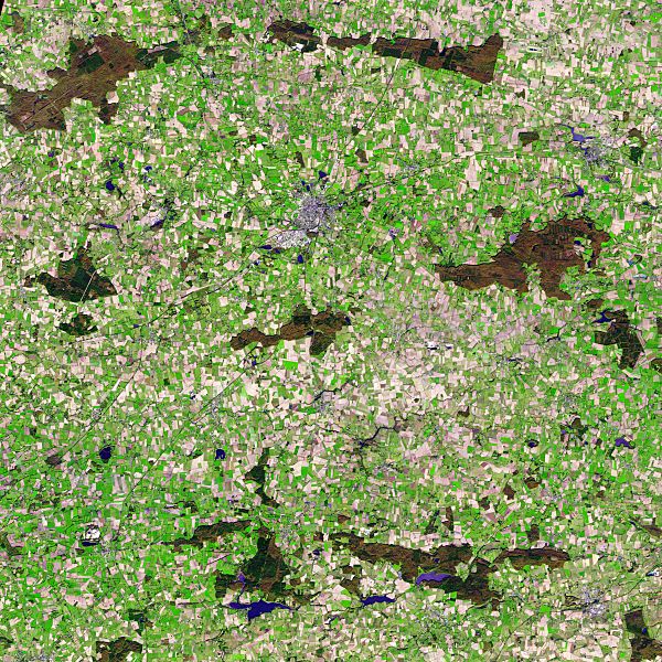
Description: Vestiges of Medieval Brittany mingle with signs of modern civilization in this simulated natural colour satellite image of Châteaubriant, France. The small city is silver, coloured by light bouncing off the reflective surfaces of modern times. The surrounding country is an irregular patchwork of small fields, reflecting land use in the Middle Ages. The image does not show what you would see if you were in an air-plane over the city like a natural colour satellite image would, but rather, it shows the region in a combination of visible and infra-red light. Plant-covered land is still green and water is dark blue, so this particular combination is called simulated natural colour. By late November, crops had been harvested and many of the fields were bare. The exposed soil ranges from pale tan to brown in the image. Other fields (possibly pastures) remained green, even late in the year. Patches of forest on the right and lower edges of the image are brown and dark green.
Title: Chateaubriant, France
Credit: NASA Earth Observatory
Author: Jesse Allen
Usage Terms: Public domain
License: Public domain
Attribution Required?: No
Image usage
The following page links to this image:
