
Image: Cheik-Saïd 1938
Size of this preview: 424 × 599 pixels. Other resolutions: 170 × 240 pixels | 468 × 661 pixels.
Original image (468 × 661 pixels, file size: 133 KB, MIME type: image/jpeg)
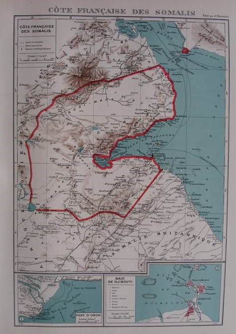
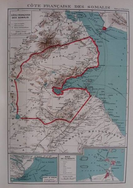
Description: Map of French Somaliland, from the Atlas colonial français published by L'Illustration (1938 edition). On the other side of the Strait of Bab el-Mandeb, Cheik-Saïd is clearly shown as a French possession, although it was not. This map shows the new Italian Eritrea-French Somaliland border as per the Laval-Mussolini Accord of January 1935. After WWII, the border was pushed back north, to what it had been before 1935.
Title: Cheik-Saïd 1938
Credit: Delcampe.net auction
Author: Édition L'Illustration, 1938
Usage Terms: Public domain
License: Public domain
Attribution Required?: No
Image usage
The following 2 pages link to this image:

All content from Kiddle encyclopedia articles (including the article images and facts) can be freely used under Attribution-ShareAlike license, unless stated otherwise.