
Image: Chepiwanoxet-1777
No higher resolution available.
Chepiwanoxet-1777.jpg (291 × 435 pixels, file size: 64 KB, MIME type: image/jpeg)
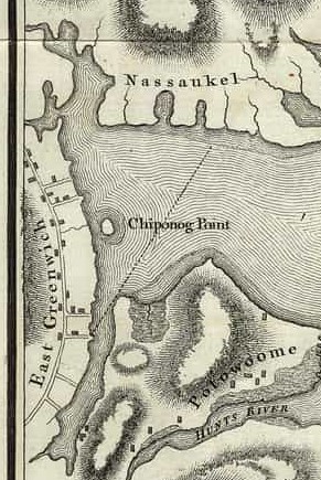
Description: A cropped section from the Charles Blaskowitz 1777 nautical chart of Narragansett Bay printed by William Faden of Charing Cross London at the behest of Lt. General Hugh Percy of the British Royal Armed Forces. Included in this excerpt are western Greenwich Bay, Greenwich Cove, Potowomut Peninsula, and Chepiwanoxet (Chiponog) Point drawn as an Island.
Title: Chepiwanoxet-1777
Credit: https://bostonraremaps.com/wp-content/uploads/2019/06/BRM3297-Blaskowitz-Narragansett-Bay-1777_lowres.jpg
Author: Charles Blaskowitz engraving; William Faden printing
Usage Terms: Public domain
License: Public domain
Attribution Required?: No
Image usage
The following page links to this image:

All content from Kiddle encyclopedia articles (including the article images and facts) can be freely used under Attribution-ShareAlike license, unless stated otherwise.