
Image: Cherry Springs 1938 Aerial Photo Crop

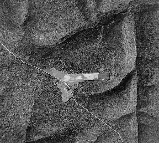
Description: Cropped aerial photo of Cherry Springs State Park and adjoining airport in West Branch Township, Potter County, Pennsylvania in the United States. Pennsylvania Route 44 (the Coudersport-Jersey Shore Turnpike) is the highway crossing diagonally from upper left to bottom right. North is up. West Branch Pine Creek is in the valley north of the park, and Hopper House Run is in the valley to the east.
Title: Cherry Springs 1938 Aerial Photo Crop
Credit: Penn Pilot, "a project sponsored by the Pennsylvania Geological Survey, is an online library of digital historical aerial photography for the Commonwealth of Pennsylvania." Original file name was "potter_100738_aqc_10_18.jpg"
Author: According to this, "The photos were produced by the United States Department of Agriculture, Agricultural Adjustment Administration (now known as the Farm Service Agency)." Cropped by uploader.
Permission: This image or file is a work of a United States Department of Agriculture employee, taken or made as part of that person's official duties. As a work of the U.S. federal government, the image is in the public domain.
Usage Terms: Public domain
License: Public domain
Attribution Required?: No
Image usage
The following page links to this image:
