
Image: Chester's City Walls - Bridgegate to Eastgate ^2 - geograph.org.uk - 372176
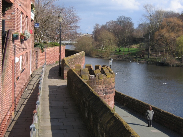
Description: Chester's City Walls - Bridgegate to Eastgate #2 This view is taken from near the bottom of the steps on the east side of the Bridgegate. The half round edifice attached to the walls is the base of the medieval Round Tower, the upper part of which was demolished in the 18th century. The road below is only a walkway and cycleway now, and the River Dee is to the right of that. The footpath to the left of the walls is a long ramp from Lower Bridge Street, which again provides access to the walls for wheelchair users. The next photo in this series is taken from the far side of the round tower - see 372205 .
Title: Chester's City Walls - Bridgegate to Eastgate ^2 - geograph.org.uk - 372176
Credit: From geograph.org.uk
Author: John S Turner
Usage Terms: Creative Commons Attribution-Share Alike 2.0
License: CC BY-SA 2.0
License Link: http://creativecommons.org/licenses/by-sa/2.0
Attribution Required?: Yes
Image usage
The following image is a duplicate of this image (more details):
The following page links to this image:
