
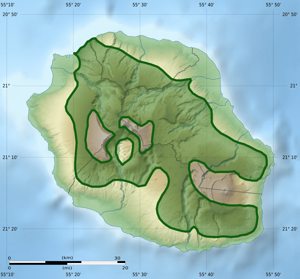
Image: Circus maillardi distribution 1973-1975
Size of this preview: 645 × 600 pixels. Other resolutions: 258 × 240 pixels | 1,037 × 964 pixels.
Original image (1,037 × 964 pixels, file size: 413 KB, MIME type: image/png)
Description: Distribution Map of the Réunion Harrier (Circus maillardi) from 1973 to 1975. Based on: E. W. Diamond (Ed.): Studies of Mascarene Island Birds. Cambrigde University Press, Cambridge 1987. pp. 311–314.
Title: Circus maillardi distribution 1973-1975
Credit: File:La Réunion department relief location map.jpg
Author: La Réunion department relief location map.jpg: Eric Gaba (Sting - fr:Sting) derivative work: Toter Alter Mann (talk)
Usage Terms: Creative Commons Attribution-Share Alike 3.0
License: CC BY-SA 3.0
License Link: https://creativecommons.org/licenses/by-sa/3.0
Attribution Required?: Yes
Image usage
The following page links to this image:

All content from Kiddle encyclopedia articles (including the article images and facts) can be freely used under Attribution-ShareAlike license, unless stated otherwise.