
Image: Clan Macdonald of Sleat map

Size of this PNG preview of this SVG file: 506 × 600 pixels. Other resolution: 202 × 240 pixels.
Original image (SVG file, nominally 808 × 958 pixels, file size: 627 KB)
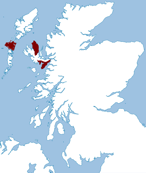
Description: This map illustrates the lands possessed by the chiefs of the Macdonalds of Sleat in the late 16th century (1587-1594). This map is based upon the "Map of the clans of Scotland with the possessions of the Highland Proprietors according to the Acts of Parliament of 1587 & 1594".
Title: Clan Macdonald of Sleat map
Credit: Own workusing the following image: File:Scotland location map.svg by User:NordNordWest
Author: Celtus (talk)
Usage Terms: Creative Commons Attribution-Share Alike 3.0
License: CC BY-SA 3.0
License Link: https://creativecommons.org/licenses/by-sa/3.0
Attribution Required?: Yes
Image usage
The following page links to this image:

All content from Kiddle encyclopedia articles (including the article images and facts) can be freely used under Attribution-ShareAlike license, unless stated otherwise.