
Image: Clement Reid - Map Doggerbank
Size of this preview: 474 × 600 pixels. Other resolutions: 190 × 240 pixels | 1,020 × 1,291 pixels.
Original image (1,020 × 1,291 pixels, file size: 464 KB, MIME type: image/jpeg)
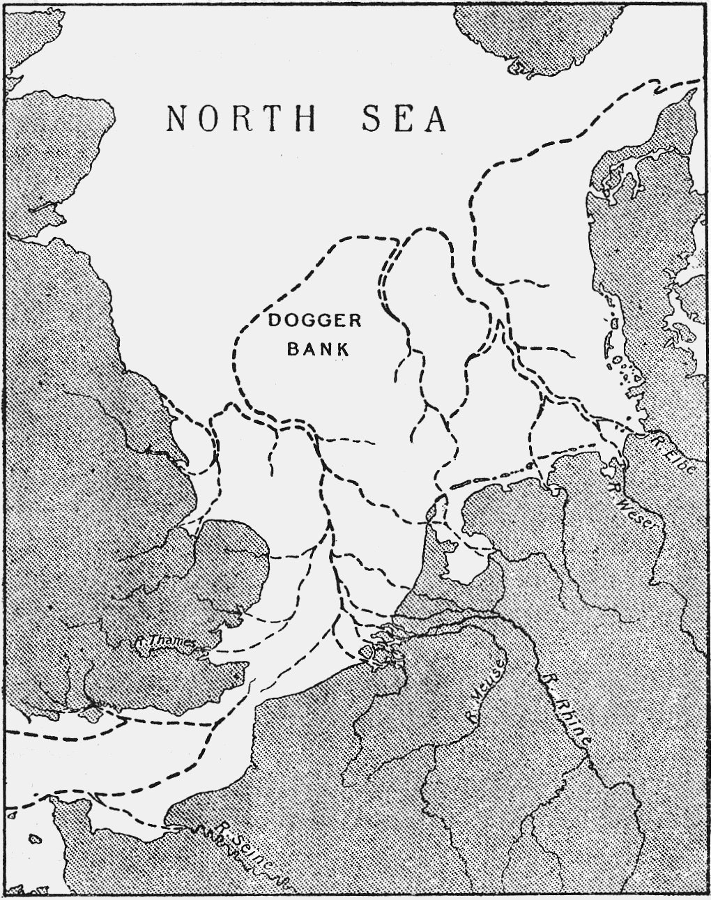
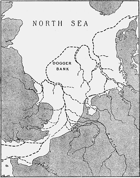
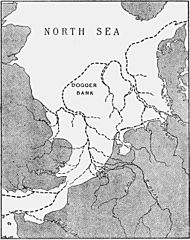
Description: Map of Doggersbank, North Sea, "showing approximate Coast-line at the period of the lowest Submerged Forest"
Title: Clement Reid - Map Doggerbank
Credit: Clement Reid, 1913. Submerged Forests
Author: Clement Reid
Usage Terms: Public domain
License: Public domain
Attribution Required?: No
Image usage
The following page links to this image:

All content from Kiddle encyclopedia articles (including the article images and facts) can be freely used under Attribution-ShareAlike license, unless stated otherwise.