
Image: Cliffs of Moher postcard circa 1890–1900
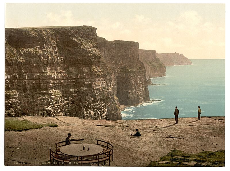
Description: Nineteenth century Photochrom postcard of the Cliffs of Moher in County Clare in Ireland showing cliffside table and refreshments. The flat rock platform in the foreground is identified on Ordnance Survey maps as Leacmayornagneeve and the alternative name, Lakvearnagnive, is recorded in the Ordnance Survey Name Book for the area. These names are anglicized versions of the original Irish language name, Leac Mhaoir na nGníomh, meaning "flagstone of the steward of the deeds/actions".[1] It is unknown who the steward was or what actions of his are commemorated in the name of this physical feature. A circular table and seating were installed at the edge of the cliff in the past, as seen in the picture. Although only about 10 metres deep, Leacmayornagneeve is marked clearly on nineteenth century 6-inch ordnance survey maps of the area, and even the circular seating is clearly drawn on old 25-inch maps. The table and seating are no longer there and visitors are discouraged nowadays from going to the edge of the cliff at this point to peer at the Atlantic Ocean far below, because of the danger. [1] Original Irish name and meaning of Leacmayornagneeve courtesy of the Placenames Database of Ireland.
Title: Cliffs of Moher postcard circa 1890–1900
Credit: https://www.flickr.com/photos/library_of_congress/4427440202/in/photostream/
Author: Library of Congress, Prints and Photographs Division, Washington, D.C. 20540 USA
Usage Terms: Public domain
License: Public domain
Attribution Required?: No
Image usage
The following page links to this image:
