
Image: Collet Map excerpt showing Fort Dobbs
Size of this preview: 800 × 521 pixels. Other resolutions: 320 × 208 pixels | 1,337 × 871 pixels.
Original image (1,337 × 871 pixels, file size: 469 KB, MIME type: image/jpeg)
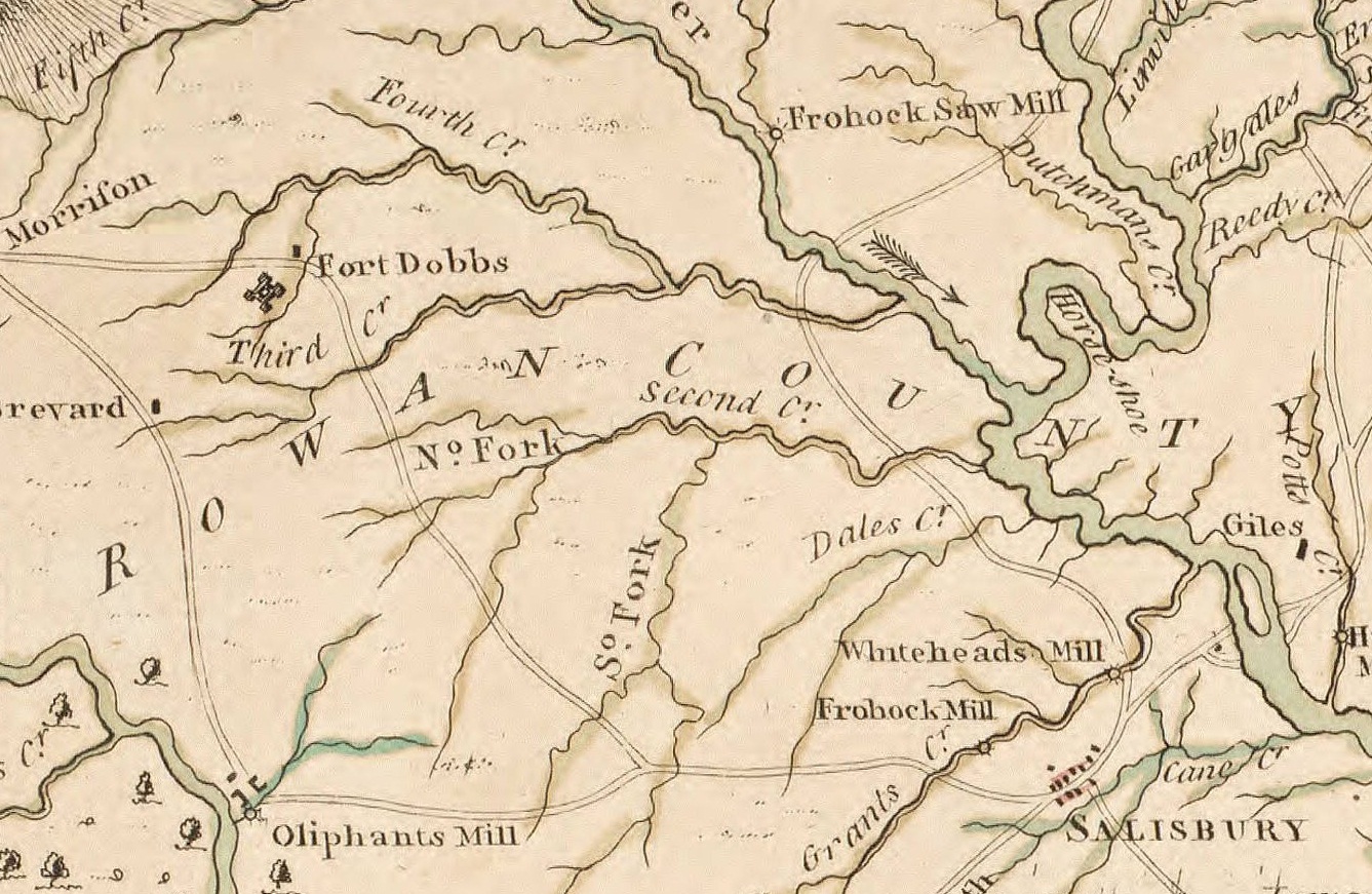
Description: An excerpt of John Collet's 1770 map of North Carolina depicting the Carolina back-country, including Charlotte, Salisbury, Salem, and Fort Dobbs.
Title: Collet Map excerpt showing Fort Dobbs
Credit: Original publication: London, 1770 Immediate source: University of North Carolina Digital Collections (http://dc.lib.unc.edu/cdm/ref/collection/ncmaps/id/467)
Author: John Collet, J. Bayly, S. Hooper (Life time: ca. 1789)
Usage Terms: Public domain
License: PD
License Link: //en.wikipedia.org/wiki/File:Collet_Map_excerpt_showing_Fort_Dobbs.jpg
Attribution Required?: No
Image usage
The following page links to this image:

All content from Kiddle encyclopedia articles (including the article images and facts) can be freely used under Attribution-ShareAlike license, unless stated otherwise.