
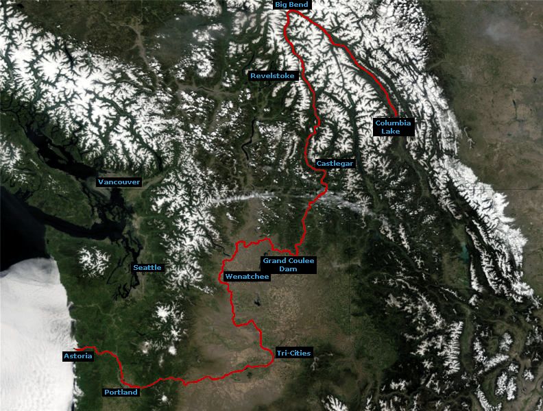
Image: Columbia River route on satellite image
No higher resolution available.
Columbia_River_route_on_satellite_image.jpg (792 × 600 pixels, file size: 120 KB, MIME type: image/jpeg)
Description: A revised version of the previous file. This revised image shows the entire run of the Columbia River including the Big Bend area in BC. Image created by me overlaid on a public-domain satellite image from NASA. NASA image source: [1]. NASA image ID: Washington.A2002164.1900.250m.jpg.
Title: Columbia River route on satellite image
Credit: Transferred from en.wikipedia to Commons.
Author: DanMS at English Wikipedia
Usage Terms: Creative Commons Attribution-Share Alike 3.0
License: CC-BY-SA-3.0
License Link: http://creativecommons.org/licenses/by-sa/3.0/
Attribution Required?: Yes
Image usage
The following page links to this image:

All content from Kiddle encyclopedia articles (including the article images and facts) can be freely used under Attribution-ShareAlike license, unless stated otherwise.