
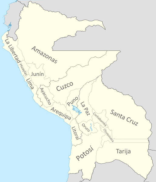
Image: Confederación Perú-Boliviana

Description: Map of the Peru-Bolivian Confederation. It includes all the disputed territories (The border with Ecuador, Colombia and Brazil in the Amazon, the Atacama Corridor with Chile, the Chacho with Paraguay and Tarija with Argentina, in addition to the Puna de Atacama).
Title: Confederación Perú-Boliviana
Credit: Own work Coastline extracted from: File:Ecuador location map.svg & File:Chile location map.svg by NordNordWest & File:Peru location map.svg by Spischot
Author: Janitoalevic Coastline extracted from: File:Ecuador location map.svg & File:Chile location map.svg by NordNordWest & File:Peru location map.svg by Spischot
Usage Terms: GNU Free Documentation License
License: GFDL
License Link: http://www.gnu.org/copyleft/fdl.html
Attribution Required?: Yes
Image usage
The following page links to this image:
