
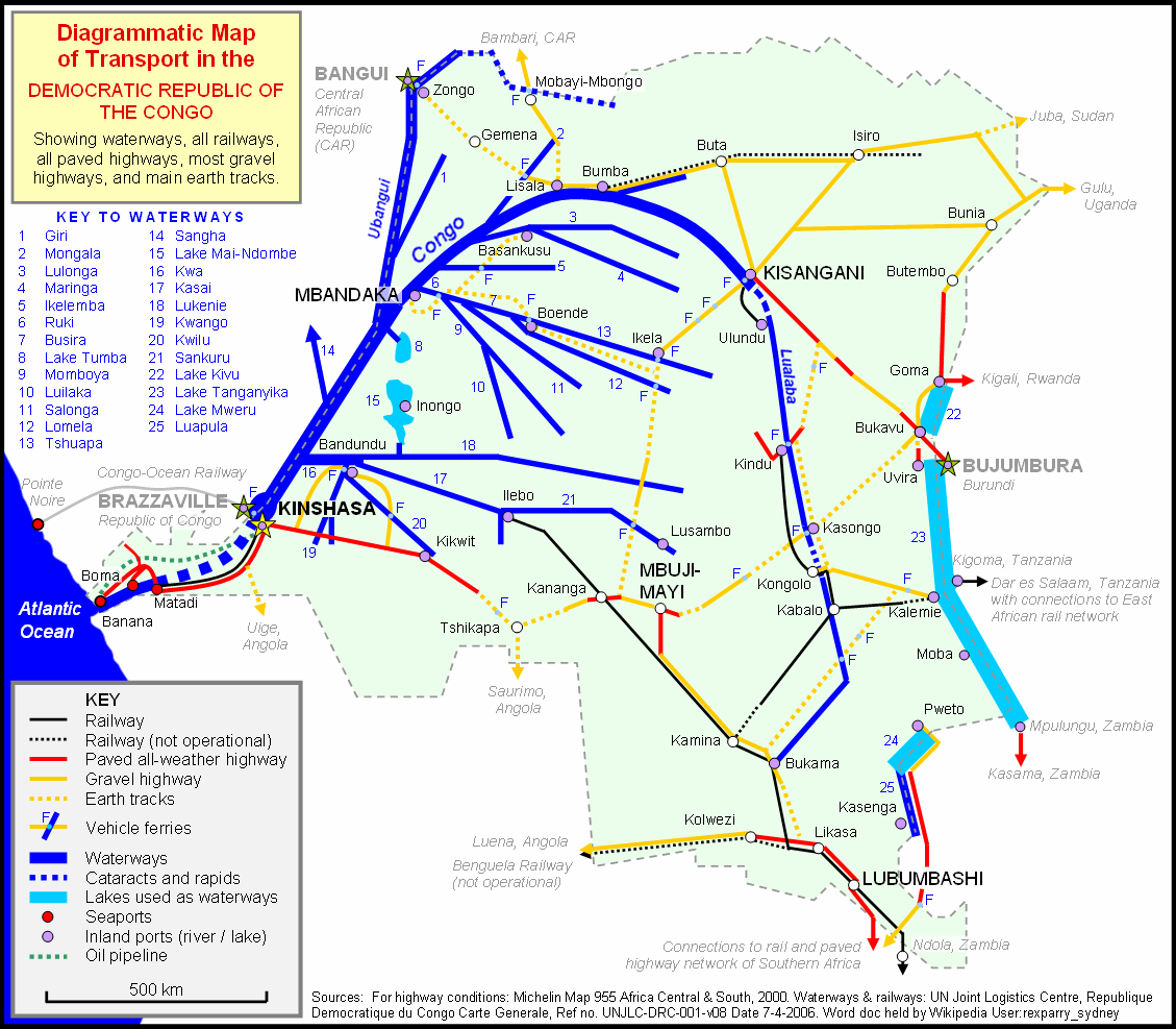
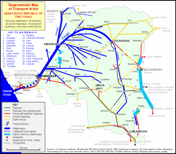
Image: Congo Transport Map
Size of this preview: 686 × 600 pixels. Other resolutions: 275 × 240 pixels | 1,129 × 987 pixels.
Original image (1,129 × 987 pixels, file size: 76 KB, MIME type: image/png)
Description: Diagrammatic map of ground and water transport in the Democratic Republic of Congo
Title: Congo Transport Map
Credit: Own work drawn in Word document
Author: Rexparry_sydney
Usage Terms: Creative Commons Attribution 2.5
License: CC BY 2.5
License Link: https://creativecommons.org/licenses/by/2.5
Attribution Required?: Yes
Image usage
The following page links to this image:

All content from Kiddle encyclopedia articles (including the article images and facts) can be freely used under Attribution-ShareAlike license, unless stated otherwise.