
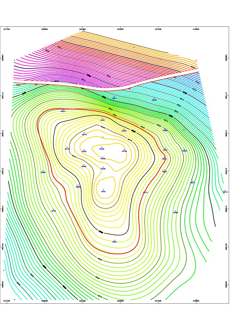
Image: Contour map software screen snapshot of isopach map for 8500ft deep OIL reservoir with a Fault line
Description: Screenshot of a structure map generated by Contour map software for an 8500ft deep gas & Oil reservoir in the Erath field, Vermilion Parish, Erath, Louisiana. The left-to-right gap, near the top of the contour map indicates a Fault line. This fault line is between the blue/green contour lines and the purple/red/yellow contour lines. The thin red circular contour line in the middle of the map indicates the top of the oil reservoir. Because gas floats above oil, the thin red contour line marks the gas/oil contact zone.
Title: Contour map software screen snapshot of isopach map for 8500ft deep OIL reservoir with a Fault line
Credit: Sent to me personally
Author: Richard Banks
License: Attribution
Image usage
The following page links to this image:
