
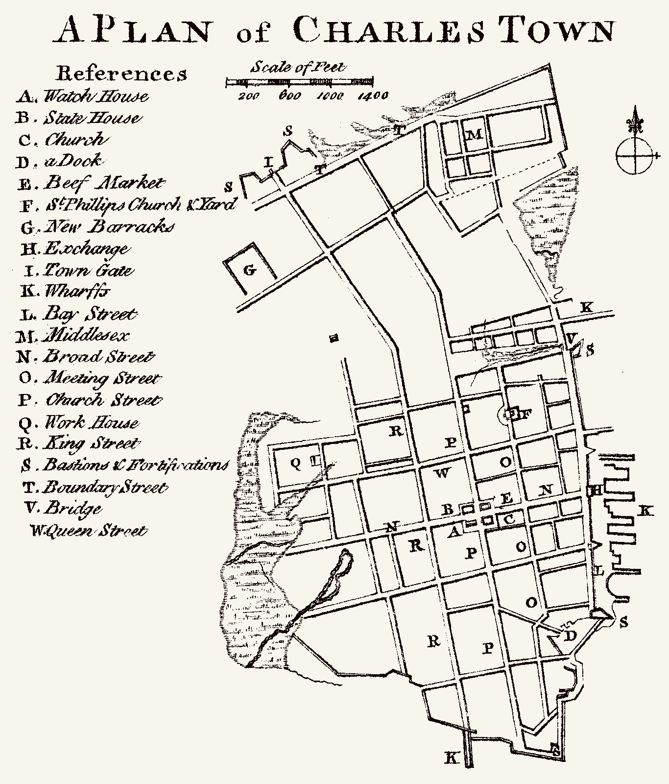
Image: Cook, James — 1773 Map of Charles Town
Description: Charles Town inset from "A Map of the Province of South Carolina with all the Rivers, Creeks, Bays, Inletts, Islands, Inland Navigation, Soundings, Time of High Water on the Sea Coast, Roads, Marshes, Ferrys, Bridges, Swamps, Parishes Churches, Towns, Townships; Country Parish District and Provincial Lines. Humbly inscribed to the Hon.ble Lawlins Lownds Esqr. Speaker & the rest of the Members of the Hon.ble the Commons House of Assembly of the Province by their most Obedt. & faithfull Servt Jams Cook. Thos. Bowen, sculpt. 1773."
Title: Cook, James — 1773 Map of Charles Town
Credit: http://www.davidrumsey.com/luna/servlet/detail/RUMSEY~8~1~1221~90171:A-Map-of-the-Province-of-South-Caro#
Author: James Cook
Usage Terms: Public domain
License: Public domain
Attribution Required?: No
Image usage
The following page links to this image:
