
Image: Corea-map
Size of this preview: 492 × 599 pixels. Other resolutions: 197 × 240 pixels | 4,620 × 5,629 pixels.
Original image (4,620 × 5,629 pixels, file size: 10.24 MB, MIME type: image/jpeg)
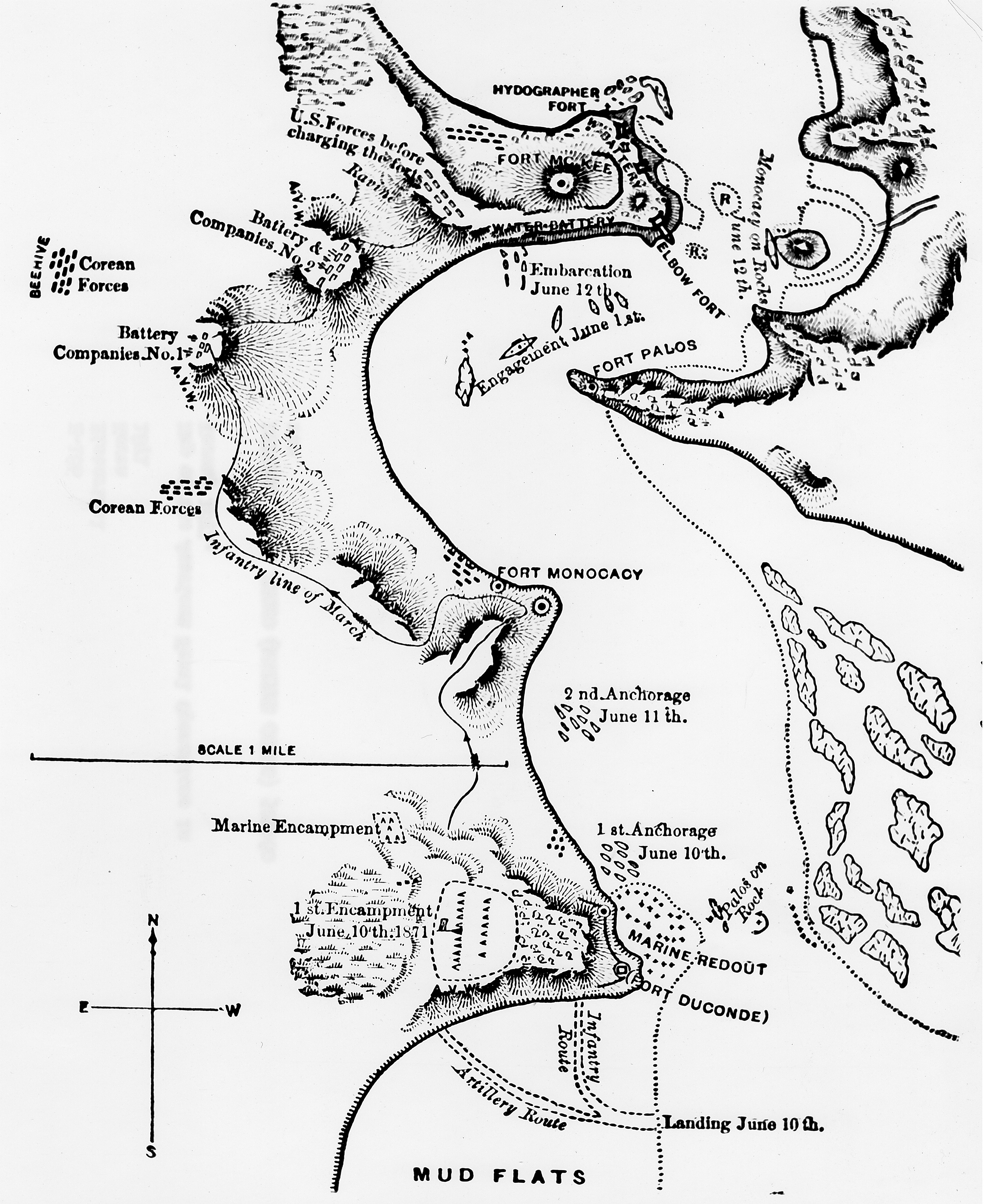
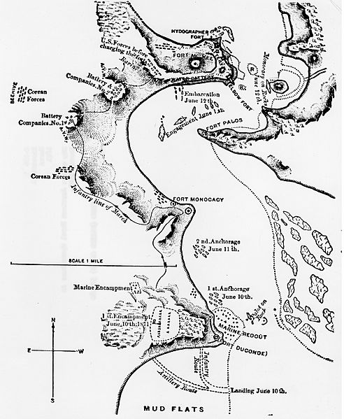
Description: American map of Korean forts on Ganghwa Island during the United States expedition to Korea, 1871. The maps depict forts, named by the U.S. navy warships which took part in their destruction in the Battle of Ganghwa.
Title: Corea-map
Credit: USMC Historical Division Photograph Archives
Author: Defense Department Photograph (Marine Corps) 521480
Permission: This file is a work of a United States Marine or employee, taken or made as part of that person's official duties. As a work of the U.S. federal government, it is in the public domain.
Usage Terms: Public domain
License: Public domain
Attribution Required?: No
Image usage
The following page links to this image:

All content from Kiddle encyclopedia articles (including the article images and facts) can be freely used under Attribution-ShareAlike license, unless stated otherwise.