
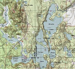
Image: Corner-Straits Chain and Blue Lake

Size of this preview: 650 × 600 pixels. Other resolutions: 260 × 240 pixels | 726 × 670 pixels.
Original image (726 × 670 pixels, file size: 334 KB, MIME type: image/jpeg)
Description: A cropped portion of the USGS Corner Lake quadrangle topo map. 1982 version; current: 1985
Title: Corner-Straits Chain and Blue Lake
Credit: USGS Quadrangle map for Corner Lake, MI version 1982; current as of 1985
Author: USGS
Usage Terms: Public domain
License: Public domain
Attribution Required?: No
Image usage
The following 2 pages link to this image:

All content from Kiddle encyclopedia articles (including the article images and facts) can be freely used under Attribution-ShareAlike license, unless stated otherwise.