
Image: Corsica-Romana
Size of this preview: 297 × 599 pixels. Other resolutions: 119 × 240 pixels | 614 × 1,238 pixels.
Original image (614 × 1,238 pixels, file size: 156 KB, MIME type: image/jpeg)
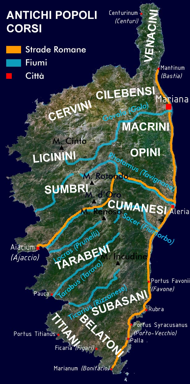
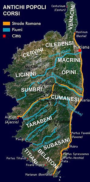
Description: Simplified Map of Corsica, indicating the geographic distribution of the ancient Corsican Tribes, the main cities and roads in the Roman age. Created by myself based on a satellite image acquired through NASA World Wind 1.3.
Title: Corsica-Romana
Credit: Own work
Author: Piero Montesacro
Usage Terms: Public domain
License: Public domain
Attribution Required?: No
Image usage
The following page links to this image:

All content from Kiddle encyclopedia articles (including the article images and facts) can be freely used under Attribution-ShareAlike license, unless stated otherwise.