
Image: Covered bridges in Columbia County, Pennsylvania
No higher resolution available.
Covered_bridges_in_Columbia_County,_Pennsylvania.png (456 × 532 pixels, file size: 84 KB, MIME type: image/png)
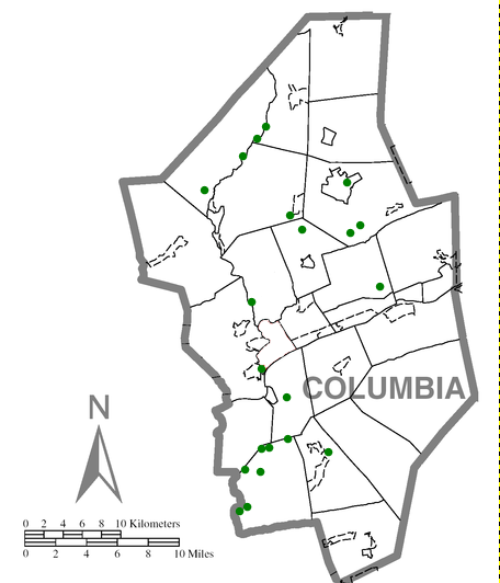
Description: A map of the approximate location of all existing covered bridges in Columbia County, Pennsylvania, as of 2007. The green dots are the bridges.
Title: Covered bridges in Columbia County, Pennsylvania
Credit: File:Map_of_Bloomsburg,_Columbia_County,_Pennsylvania_Highlighted.png
Author: I created this image as a derivative work of an image by Derek Ramsay.
Usage Terms: Creative Commons Attribution-Share Alike 2.5
License: CC BY-SA 2.5
License Link: https://creativecommons.org/licenses/by-sa/2.5
Attribution Required?: Yes
Image usage
The following page links to this image:

All content from Kiddle encyclopedia articles (including the article images and facts) can be freely used under Attribution-ShareAlike license, unless stated otherwise.