
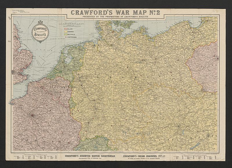
Image: Crawford's war map no 2 presented by the proprietors of Crawford's Biscuits (5003845)

Size of this preview: 800 × 579 pixels. Other resolutions: 320 × 232 pixels | 5,000 × 3,621 pixels.
Original image (5,000 × 3,621 pixels, file size: 3.7 MB, MIME type: image/jpeg)
Description: WWI map from the collections of the National Library of Wales
Title: Crawford's war map no. 2 presented by the proprietors of Crawford's Biscuitslabel QS:Len,"Crawford's war map no. 2 presented by the proprietors of Crawford's Biscuits" label QS:Lcy,"Crawford's war map no. 2 presented by the proprietors of Crawford's Biscuits"
Credit: This image is available from the National Library of Wales You can view this image in its original context on the NLW Catalogue
Usage Terms: Public domain
License: Public domain
Attribution Required?: No
Image usage
The following page links to this image:

All content from Kiddle encyclopedia articles (including the article images and facts) can be freely used under Attribution-ShareAlike license, unless stated otherwise.
.jpg)