
Image: Crosland's Mill, Blackmoorfoot Road - geograph.org.uk - 499088
No higher resolution available.
Crosland's_Mill,_Blackmoorfoot_Road_-_geograph.org.uk_-_499088.jpg (640 × 423 pixels, file size: 67 KB, MIME type: image/jpeg)
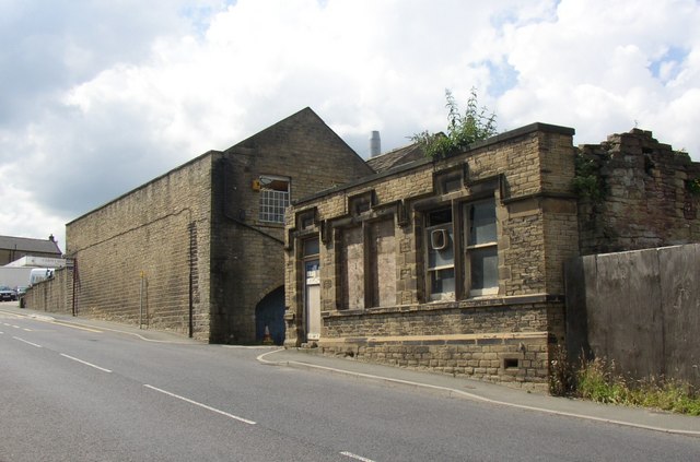
Description: Crosland's Mill, Blackmoorfoot Road. That was the name on the 1850 OS map, with '(Woollen)' after it. The road was called 'Manchester Old Road' then. By 1907 it was 'Crosland Moor Mills', Crosland having become the place rather than the owner. The ruined building on the right appears to have been the mill office.
Title: Crosland's Mill, Blackmoorfoot Road - geograph.org.uk - 499088
Credit: From geograph.org.uk
Author: Humphrey Bolton
Usage Terms: Creative Commons Attribution-Share Alike 2.0
License: CC BY-SA 2.0
License Link: https://creativecommons.org/licenses/by-sa/2.0
Attribution Required?: Yes
Image usage
The following page links to this image:

All content from Kiddle encyclopedia articles (including the article images and facts) can be freely used under Attribution-ShareAlike license, unless stated otherwise.