
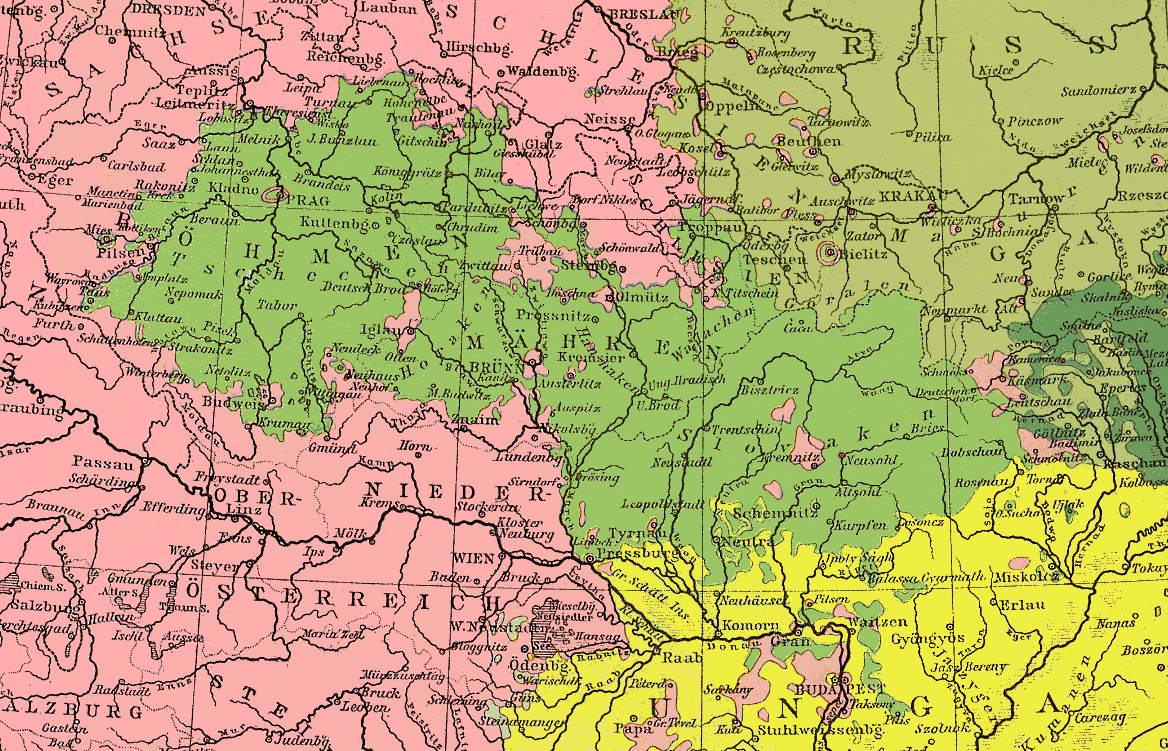
Image: Czechs Slovakians1880
Description: Area of Czech and Slovakian languages in the Austrian monarchy in the 19th century. The meaning of most colours can be understood from the map. The "RUSS…" in the northeast means that the major part of Poland belonged to the Russian empire, the olive colour represents Polish. The dark green in the east are Ruthenians (Ukrainians). The light spots near the border of Germans and Magyars (Hungarians) are Croatians.
Title: Czechs Slovakians1880
Credit: Cut of "Völkerkarte von Oesterreich-Ungarn", Andrées Weltatlas 1880
Author: Scan and upload by User:Ulamm
Permission: Permission by Cornelsen Verlag, the descender of the editor
Usage Terms: Public domain
License: Public domain
Attribution Required?: No
Image usage
The following page links to this image:
