
Image: D'Anville Amérique Septentrionale 1746 UTA 2

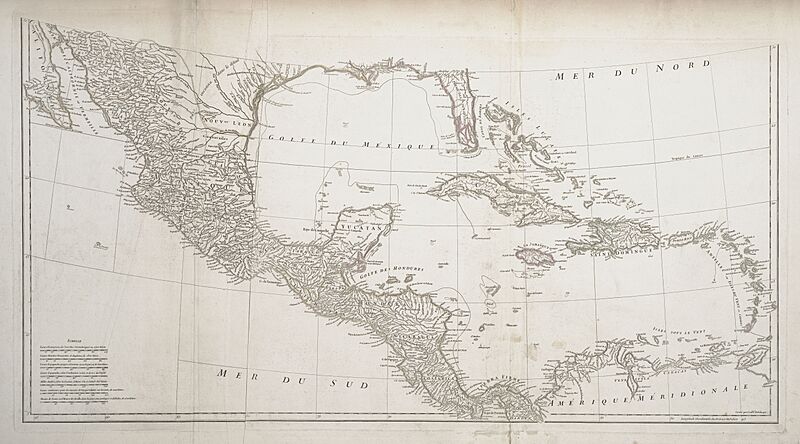
Description: The research d'Anville conducted for this map included reading several decades' worth of exploration and travel narratives as well as maps by his predecessors and contemporaries, yet he realized there were still vast areas of the continent where nothing was yet known. D'Anville's map of North America corrected much of the exaggerations and distortions found on Delisle's earlier maps, adding newer, more precise information about the shapes of the Great Lakes and the configuration of the Mississippi basin, including the lower Missouri, Arkansas, and lower Red Rivers. Along the lower Missouri, for example, d'Anville depicted Fort d'Orléans (established in 1723) after carefully studying accounts by its founder, Étienne de Veniard, Sieur de Bourgmont (1679-1734), who had returned to France in 1725 with his Missouria wife and a number of Native American tribal representatives. Important sources for the Gulf coast were the field survey maps of French engineer Valentin Devin (d. 1735), who had first arrived in Louisiana in 1719.
Title: Amérique Septentrionale
Credit: UTA Libraries Cartographic Connections: map / text
Author: Jean Baptiste Bourguignon d'Anville / Hubert-François Gravelot
Usage Terms: Public domain
License: Public domain
Attribution Required?: No
Image usage
The following page links to this image:
