
Image: DMIR Map
Size of this preview: 744 × 600 pixels. Other resolutions: 298 × 240 pixels | 1,082 × 872 pixels.
Original image (1,082 × 872 pixels, file size: 8 KB, MIME type: image/png)
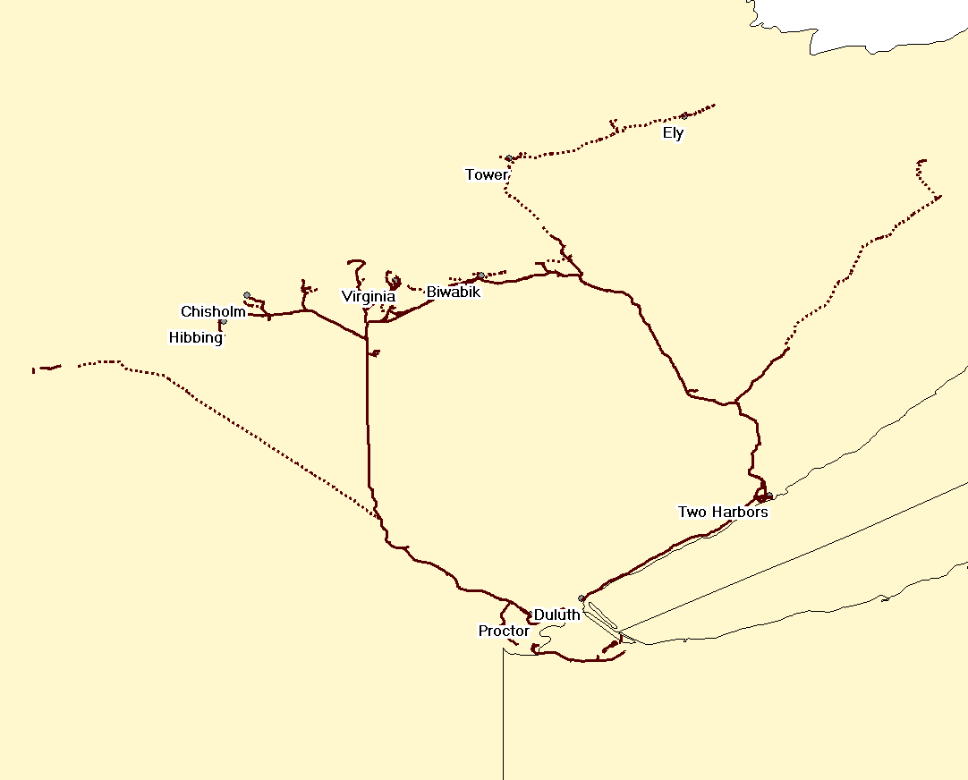
Description: Map of the en:Duluth, Missabe and Iron Range Railway. Solid lines are tracks still in use; dotted lines are abandoned. The section from Two Harbors to Duluth is effectively operated by the en:North Shore Scenic Railroad although the en:DMIR (now en:CN) retain the exclusive right (unexercised) to operate freight traffic.
Title: DMIR Map
Credit: Transferred from en.wikipedia to Commons.
Author: Elkman at English Wikipedia
Usage Terms: Creative Commons Attribution-Share Alike 3.0 truetrue
License: CC-BY-SA-3.0
License Link: http://creativecommons.org/licenses/by-sa/3.0/
Attribution Required?: Yes
Image usage
The following page links to this image:

All content from Kiddle encyclopedia articles (including the article images and facts) can be freely used under Attribution-ShareAlike license, unless stated otherwise.