
Image: Dcaairportmap
Size of this preview: 597 × 599 pixels. Other resolutions: 239 × 240 pixels | 1,000 × 1,004 pixels.
Original image (1,000 × 1,004 pixels, file size: 382 KB, MIME type: image/png)
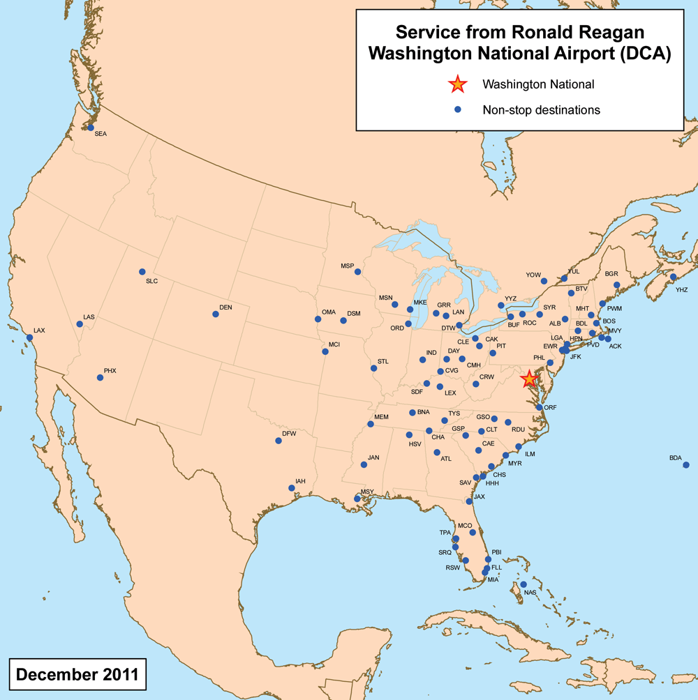
Description: This is a route map for Ronald Reagan Washington National Airport as of May 2009. Map is an Azimuthal equidistant projection centered on the airport so straight lines from Washington are along great circle routes. Source.
Title: Dcaairportmap
Credit: No machine-readable source provided. Own work assumed (based on copyright claims).
Author: No machine-readable author provided. Kmusser assumed (based on copyright claims).
Usage Terms: Creative Commons Attribution-Share Alike 3.0
License: CC BY-SA 3.0
License Link: http://creativecommons.org/licenses/by-sa/3.0
Attribution Required?: Yes
Image usage
The following page links to this image:

All content from Kiddle encyclopedia articles (including the article images and facts) can be freely used under Attribution-ShareAlike license, unless stated otherwise.