
Image: DemocraticSolidSouth 1876-1964
No higher resolution available.
DemocraticSolidSouth_1876-1964.png (598 × 377 pixels, file size: 13 KB, MIME type: image/png)
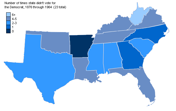
Description: A map of the states of the "Democratic Solid South" showing their voting patterns from 1876 through 1964.
Title: DemocraticSolidSouth 1876-1964
Credit: Modified version of free Wikipedia maps of US presidential election results
Author: Nbpolitico
Usage Terms: Creative Commons Attribution-Share Alike 3.0
License: CC BY-SA 3.0
License Link: https://creativecommons.org/licenses/by-sa/3.0
Attribution Required?: Yes
Image usage
The following 2 pages link to this image:

All content from Kiddle encyclopedia articles (including the article images and facts) can be freely used under Attribution-ShareAlike license, unless stated otherwise.