
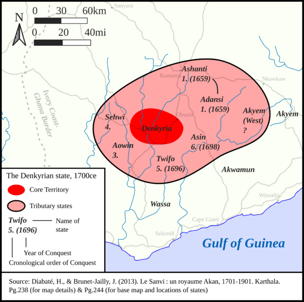
Image: Denkyrian Empire 1700ce
Size of this PNG preview of this SVG file: 604 × 600 pixels. Other resolution: 242 × 240 pixels.


Original image (SVG file, nominally 2,069 × 2,055 pixels, file size: 6.81 MB)

Description: A map of the Denkyrian Empire in 1700ce. Neighboring states are provided along with a chronology and dates for Denkyrian expansion. Modern roads and cities are provided as a frame of reference. Sources are found on the file. Lastly, Mercator (esri:54004) is the projection used for this map.
Author: HetmanTheResearcher
Usage Terms: Creative Commons Attribution-Share Alike 3.0
License: CC-BY-SA-3.0
License Link: http://creativecommons.org/licenses/by-sa/3.0/
Attribution Required?: Yes
Image usage
The following page links to this image:

All content from Kiddle encyclopedia articles (including the article images and facts) can be freely used under Attribution-ShareAlike license, unless stated otherwise.
