
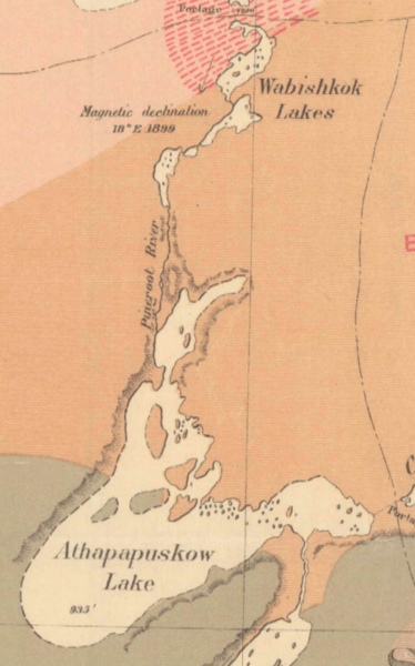
Image: Detail of 1902 Dowling Map showing Lake Athapapuskow and Pineroot River

Size of this preview: 374 × 600 pixels. Other resolutions: 149 × 240 pixels | 427 × 685 pixels.
Original image (427 × 685 pixels, file size: 440 KB, MIME type: image/png)
Description: Section of the map "Geological Map of portions of Saskatchewan, Athabaska, and Keewatin Districts 1902" A map showing the explored areas of modern day Manitoba and Saskatchewan circa 1902
Title: Detail of 1902 Dowling Map showing Lake Athapapuskow and Pineroot River
Credit: Geological Survey of Canada
Author: J.B.Tyrrell, D.B.Dowling
Usage Terms: Public domain
License: Public domain
Attribution Required?: No
Image usage
The following page links to this image:

All content from Kiddle encyclopedia articles (including the article images and facts) can be freely used under Attribution-ShareAlike license, unless stated otherwise.