
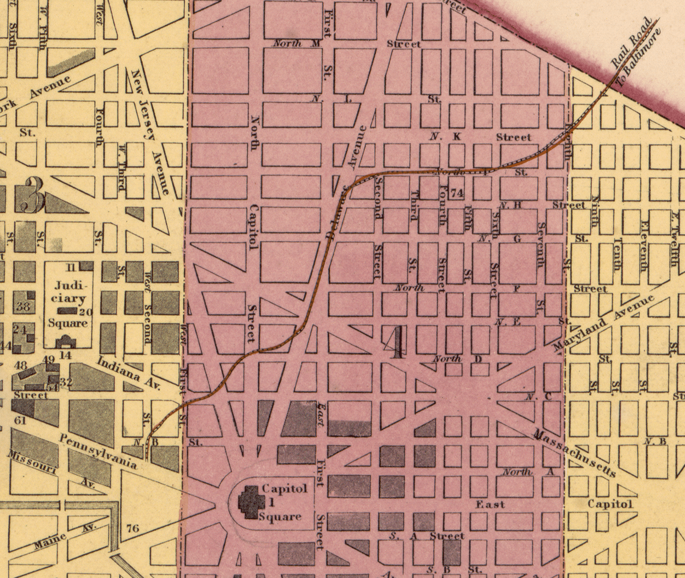
Image: Detail of a 1851 Map of Washington, DC showing the layout of the Washington Branch Line
Size of this preview: 710 × 599 pixels. Other resolutions: 284 × 240 pixels | 1,360 × 1,148 pixels.
Original image (1,360 × 1,148 pixels, file size: 1.33 MB, MIME type: image/png)
Description: Original Map from the Library of Congress: https://www.loc.gov/resource/g3850.ct004373/
Title: Detail of a 1851 Map of Washington, DC showing the layout of the Washington Branch Line
Credit: Library of Congress Geography and Map Division Washington, D.C.
Author: Mitchell, S. Augustus (Samuel Augustus), 1792-1868. Thomas, Cowperthwait & Co.
Usage Terms: Public domain
License: Public domain
Attribution Required?: No
Image usage
The following page links to this image:

All content from Kiddle encyclopedia articles (including the article images and facts) can be freely used under Attribution-ShareAlike license, unless stated otherwise.