
Image: Detroitfort
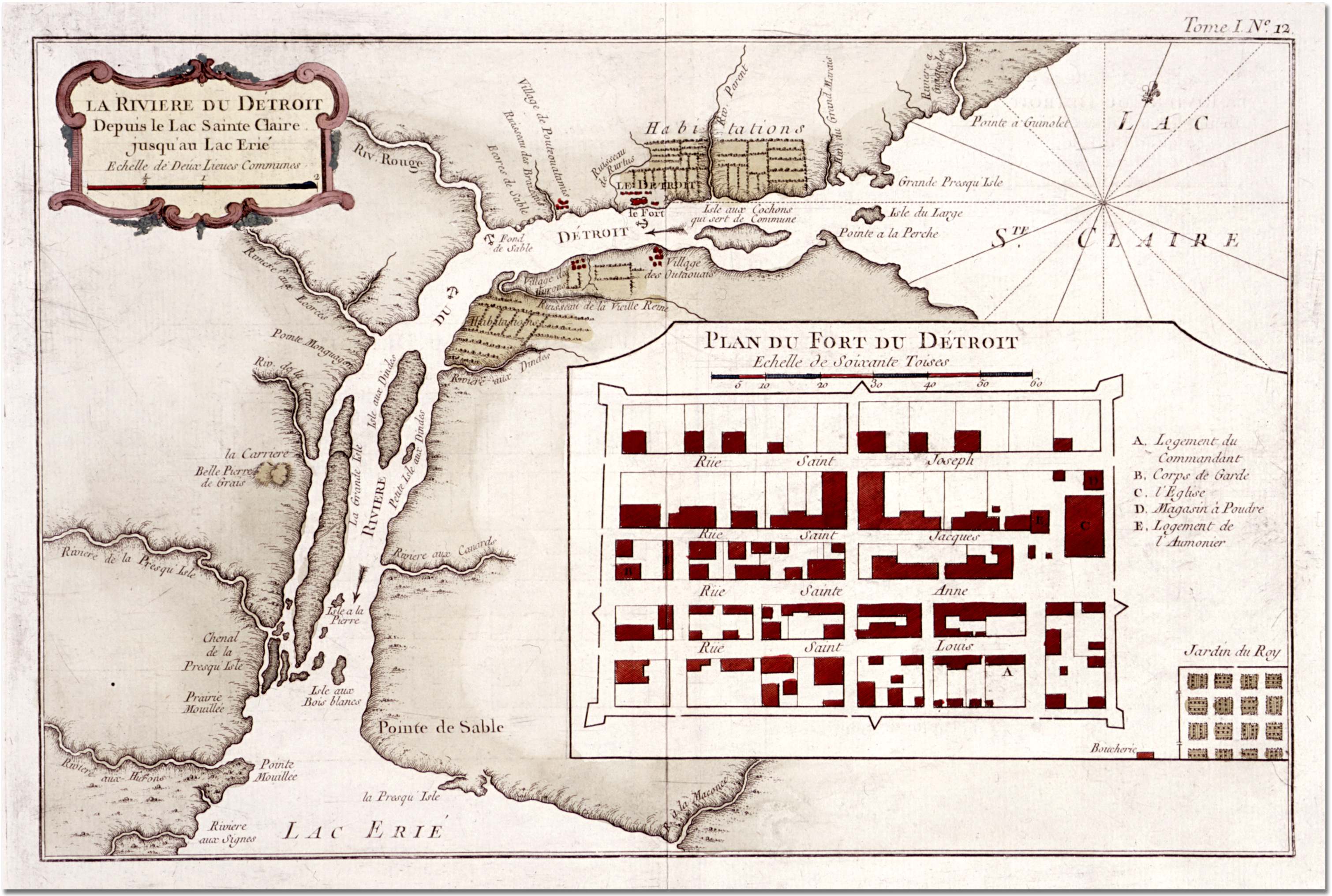
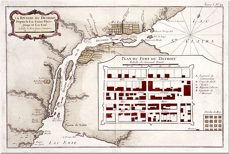
Description: NORTH AMERICA ==*map of North America* ==*map of Fort Dauphin, Labrador*: *northwest*; *northeast*; *southwest*; *southeast* ==*map of Hudson's Bay* ==*view of "Eskimos" (Canada)* ==*map of western Canada* ==*map of New Brunswick*: *northwest*; *northeast*; *southwest*; *southeast* ==*map of Cape Breton Island, Nova Scotia*: *northwest*; *northeast*; *southwest*; *southeast* ==*map of Chedabuctu Bay, Nova Scotia*: *northwest*; *northeast*; *southwest*; *southeast* ==*view of Niagara Falls* ==*map of New England*; *a closeup of the northern part* ==*map of New York* ==*map of Manhattan* ==*map of New Jersey* ==*map of Pennsylvania* ==*map of Virginia* ==*map of the Chesapeake Bay* ==*map of Carolina and Georgia* ==*map of Georgia* ==*map of Florida* ==*view of Floridians* ==*map of the Detroit region* ==*plan of the fort of Detroit* ==*map of the Illinois region* ==*map of Louisiana* ==*mouth of the Mississippi* ==*plan of New Orleans*: *northwest*; *northeast*; *southwest*; *southeast* ==*view of New Mexico* ==*view of ancient Mexico City* ==*view of a temple in ancient Mexico City* ==*view of the cemetery of sacrifice in ancient Mexico* ==*view of a sacrifice to Vitzliputzli (Mexico)* ==*view of Indian belts* ==*view of Indian dance adornments* View of Columbus meeting Indians
Title: Detroitfort
Credit: http://www.columbia.edu/itc/mealac/pritchett/00generallinks/prevost/americanorth/aa_americanorth.html
Author: l'Abbé Antoine François Prévost* with maps and views by *Jacques-Nicolas Bellin*
Usage Terms: Public domain
License: Public domain
Attribution Required?: No
Image usage
The following page links to this image:
