
Image: Dickerman Park aerial outline
No higher resolution available.
Dickerman_Park_aerial_outline.jpg (600 × 400 pixels, file size: 63 KB, MIME type: image/jpeg)
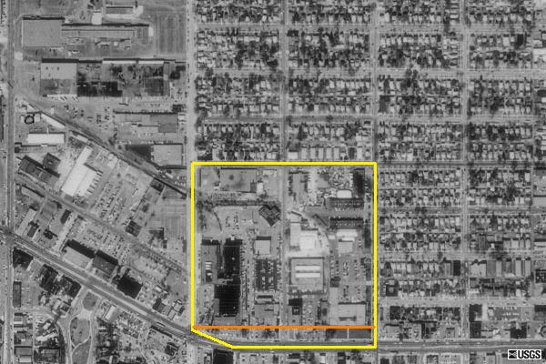
Description: The yellow outline is the Dickerman plat and the orange line shows where the current park is.
Title: Dickerman Park aerial outline
Credit: USGS Terra Server
Author: USGS
Usage Terms: Public domain
License: Public domain
Attribution Required?: No
Image usage
The following page links to this image:

All content from Kiddle encyclopedia articles (including the article images and facts) can be freely used under Attribution-ShareAlike license, unless stated otherwise.