
Image: Districts of Punjab, Pakistan

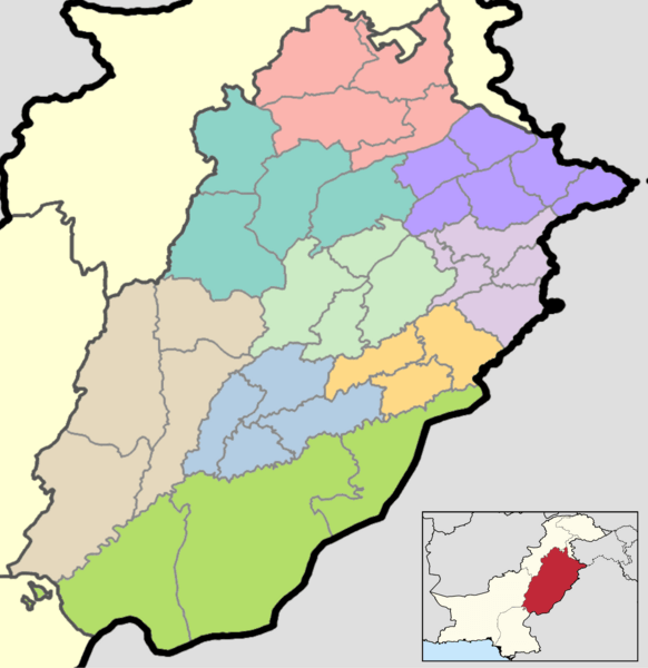
Description: This is a map showing each and every district of Punjab. The map is accurate as of September 30, 2020 and has been made using data from the Pakistan Bureau of Statistics and UN OCHA's HumData Database (which citypopulation.de uses). Each color depicts a different administrative division (higher than a district but lower than a province). The same map with each district's name shown can be found here. A map showing every district in Pakistan can be found here. A category full of these maps listed nicely can be found here.
Title: Districts of Punjab, Pakistan
Credit: Own work
Author: Abdullah Ali Abbasi
Usage Terms: Creative Commons Attribution-Share Alike 4.0
License: CC BY-SA 4.0
License Link: https://creativecommons.org/licenses/by-sa/4.0
Attribution Required?: Yes
Image usage
There are no pages that link to this image.
